• facebook
  • Twitter
  • Linkedin
  • Youtube
  • Linkedin Group
  • Post a Job
  • Post an Ad
  • Post an Event
  • Post a Directory Listing
  • Post a Press Release
  • Media Kit
  • My Account
  • Login
GoGeomatics
  • MAGAZINE
    • BIM & GIS
    • Community
    • Conference news
    • Earth Observation
    • Education & Careers
    • GEOAI
    • Announcements
    • Reality Capture & Lidar
    • Science
    • Technology
  • Directories
    • ASSOCIATION
    • INDUSTRY
    • EDUCATION
    • Open Data
  • EVENTS
    • GeoIgnite Events
    • Events Calendar
    • GoGeomatics Meetups
  • Services
    • Advertising
    • Marketing
    • Post a Job
    • Post an Ad
    • Post an Event
    • Post a Press Release
    • Post a Directory Listing
    • Media Kit
    • Web Design
  • Find a Job
  • Volunteer
    • Start a GoGeomatics Group
    • Editors & Writers Group
  • About Us
    • About Us
    • Contact Us
    • Frequently Asked Questions
  • Videos
HomeRPAS

RPAS

Education & Careers

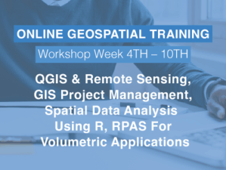
May 2022 Geospatial Training Online, QGIS, Project Management, Intro to R for GIS

19 April 2022 GoGeomatics Canada | GIS

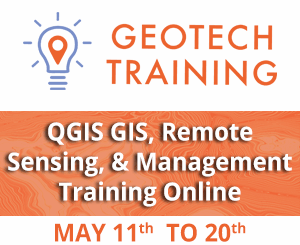
Geospatial & Location Technology Programs and Courses GeoTechTraining.com offers a wide variety of training opportunities built on current standards led by leading industry experts. Our training hub specializes in all aspects of geospatial tech. We […]

|||||
Technology

From floppy disks to cloud computing – Exploring 35 years of Remote Sensing in the NWT

21 February 2022 GoGeomatics Newsmakers | CCOG

In 1987, Frobisher Bay was renamed Iqaluit, the loonie was released by the Canadian mint, and there were 13 UTM zones that spanned across the Northwest Territories.  That was also the inaugural year for the […]

|
Community

Geospatial Training at GeoIgnite: March 4th to the 14th

14 February 2022 GoGeomatics Canada | career seminar

GeoIgnite offers a wide variety of training opportunities built on current standards led by leading industry experts. Upgrade your knowledge and skill sets. We empower our students to succeed using an online platform in a safe […]

|
Technology

Sales of Illegal RPAS Pilot Certificates and Drone Registration Cards

4 September 2020 Paul Yeung | Canadian Aviation Regulations

Transport Canada recently became aware of sales of wallet-sized “Transport Canada Drone Pilot Certificate” and “Transport Canada Certificate of Registration” via eBay through a seller located in the United States. There were listings where the Drone Pilot Certificate and Certificate of Registration were sold separately and individually. […]

||||||||
Education & Careers

QGIS: Performing Viewshed Analysis on Archaeological Sites

27 March 2017 GIS Program Langara CS | analysis

In 1927 a Vancouver bylaw was enacted that limited the height of buildings to a maximum of six stories in height over much of the West End of the city, as illustrated in the Zoning […]

||
Technology

GIS Open Source versioning tool for a multi-user Distributed Environment (part 1)

15 March 2017 Nicolas Gignac | 2014

Editors note: This article has been jointly written by Nicolas Gignac, Dami Sonoiki (eHealth Africa) and Samuel Aiyeoribe (eHealth Africa). These authors would like to thank Yves Moisan, Vincent Mora (Oslandia) and Vincent Picavet (Oslandia) for their […]

||
Technology

Outil de versionnement des données géographiques à code source ouvert pour des environnements multi-contributeurs (partie 1)

15 March 2017 Nicolas Gignac | 2014

Note des éditeurs : Cet article a été écrit conjointement par Nicolas Gignac, Dami Sonoiki (eHealth Africa) et Samuel Aiyeoribe (eHealth Africa). Ces auteurs aimeraient remercier Yves Moisan, Vincent Mora (Oslandia) et Vincent Picavet (Oslandia) pour leur support et […]

||||||
Education & Careers

Geospatial Earth Observation Using Blimps, Balloons and Kites

7 February 2017 Theresa Pinter | 2012

These days drones are all the rage. Nevertheless, there are other ways to collect data from the sky! Blimps, balloons and kites are alternative was to collecting data or remote-sensing imagery. These are great unconventional solutions for […]

Posts pagination

« 1 2 3 »

Events

Notice
There are no upcoming events.

View All Events

Services

  • Post a Job
  • Post an Ad
  • Post an Event
  • Post a Directory Listing
  • Post a Press Release
  • Media Kit
  • My Account
  • Login

Jobs

Post a Job
  • Canada Maps and Poster Gallery Volunteer Leads — GeoIgnite 2026
    remote
  • GIS & Data Analytics Lead
    Beaumont, AB
  • Lead Surveyor, Projects/Arpenteur-géomètre principal, projets; arpenteuse-géomètre principale, projets
    North Bay, Thunder Bay
  • Senior GIS Developer
    Calgary, AB
View All Jobs
  • Directories
    • Associations Directory
    • Industry Directory
    • Education Programs
    • Open Data
  • Volunteer
    • Start a GoGeomatics Group
    • Editors & Writers Group
  • About Us
    • GoGeomatics Media Kit
    • Who We Are
    • Contact Us
    • FAQ’s
    • Advertising
    • Marketing
  • Subscribe
GoGeomatics
GoGeomatics is the largest and most popular communications hub promoting the Canadian geospatial community. The business was incorporated in 2011. GoGeomatics hosts over 100 fun, free, location technology networking events each year in cities across Canada.

© 2025 GoGeomatics

  • facebook
  • Twitter
  • Linkedin
  • Youtube
  • Linkedin Group