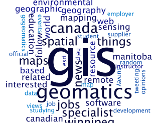
SKI

GIS Health Studies: Conduct Spatial Exposure Assessments

Interested in how to conduct different types of spatial exposure assessments for air pollution or other exposures to a population? …

BCIT GIS student project Tetrad

Become a BCIT GIS Student Project / Practicum Sponsor

The BCIT GIS department has been graduating students for 25+ years.  Our students come from BC, but as well, across…

CIG Advancements in Geomatics 2016 Conference in New Brunswick Sept 26th-28th

Advancements in Geomatics – Research and Collaboration for Informed Decisions in a Changing World The Canadian Institute of Geomatics (CIG)…

Jessi Mielke Esri’s Certification Manager Chats About the Esri Technical Certification Program

For the last 6 months I’ve been writing articles and discussing my experience in regards to the Esri technical certification…

Using Colour Transparency to Map Election Results

As the 2016 United States presidential election careens towards its conclusion in November, GIS plays a prominent role in both planning…

Canadian Institute of Geomatics Expands Executive Team with New VP Dr Brent Hall

Ottawa, August 16, 2016 – The Canadian Institute of Geomatics (CIG), the largest and most influential geospatial knowledge network in…

How Pokémon Go can encourage a love of outdoors … and family …

In a prior piece, Jonathan Murphy pointed out that fun and geospatial awareness can go together through a game. I…

Geospatial Niagara: Day of Geography, ihub, Geoparks, TreeOcode, & St. John’s Declaration

It’s hard to believe that it’s been over a year since my post introducing Geospatial Niagara to GoGeomatics Canada readers.…

University of Victoria Hosts Advanced Spatial Analysis Course

Is neighbourhood socioeconomic status associated with pediatric and childhood injuries? Are such injuries clustered in space? How can I model…

Esri Technical Associate Certification: how I passed the test

A few months ago, I decided to obtain the Esri Associate certification for ArcGIS Desktop and wrote about my reasoning here. …

Postal Codes: Canada Post Backs Down on Crowdsourced Open Data

Have you ever felt the wrath of a Canadian Crown Corporation? In 2011 Canada Post set its sights on Ervin…

SaveTheMap Campaign: What is the future of geospatial information in India

SaveTheMap Campaign: “to encourage citizens and startups to use geospatial data in everyday lives and create businesses that serve India”…