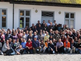
Team

Volunteer & Map Canada: Statistics Canada Crowdsourcing Pilot Project

Statistics Canada has launched a new pilot project using OpenStreetmap.  For  many Canadians outside of the geomatics community this is…

The Importance of Students & Young Professionals in Canada’s Geomatics Community

With the help of our sponsors GoGeomatics Canada is bringing students and young geospatial professionals together at 11 events from…

Earth Observation Represents a $43 Billion Opportunity Over Next 10 Years

NSR’s Satellite-Based Earth Observation (EO), 8th Edition report, released yesterday, projects data, value-added services, information products, and big data analytics…

How Canadian Remote Sensing Was Made Commercially Successful & Exportable

This piece started as a note on some of my experience as an international consultant in remote sensing specifically and…

LiDAR in Canada: Conversation with Dr. Chris Hopkinson Research Chair Remote Sensing University of Lethbridge

The author Bob Maher (BM) and Chris Hopkinson (CH) both worked as scientists at the Appied Geomatics Reearch Group (AGRG)…

Airobotics Selects SimActive’s Photogrammetry Software for its Automated Industrial Drone Solution

Montreal, Canada, August 30th, 2016 – SimActive Inc., a world-leading developer of photogrammetry software, is pleased to announce that Airobotics…

Using Colour Transparency to Map Election Results

As the 2016 United States presidential election careens towards its conclusion in November, GIS plays a prominent role in both planning…

Canadian Institute of Geomatics Expands Executive Team with New VP Dr Brent Hall

Ottawa, August 16, 2016 – The Canadian Institute of Geomatics (CIG), the largest and most influential geospatial knowledge network in…

Indoor Mapping Platform Jibestream Named as Fast Growing IoT Company

Toronto: Jibestream announced it has been named among the 30 Fastest Growing IoT Companies for 2016. Improving efficiency, productivity and…

Toronto Police Launch Student Open Data for Change Competition

Chief Mark Saunders and Ryerson University Interim Provost and Vice President Academic Dr. Christopher Evans announced a Public Safety Open…

Countdown to Launch: DigitalGlobe’s WorldView-4 Earth Imaging Satellite

Final preparations are underway at Lockheed Martin to ship DigitalGlobe’s WorldView-4 earth imaging satellite to Vandenberg Air Force Base for…

Government of Yukon Wins 2016 Esri Special Achievement in GIS Award

SAN DIEGO, Esri User Conference—June 29, 2016—Esri Canada congratulates the Government of Yukon for receiving the 2016 Esri Special Achievement…