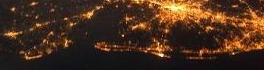
Geography Education: Changing Scale and Viewpoint
In England, as a teenager, we used to conduct ‘table top’ car rallies, using the 1 inch to 1 mile OS maps (1:63,360). The clues had to be restricted to the symbols available at that […]
GoGeomatics Canada is spear-heading a brand new Training Program that will provide opportunities for both geomatics graduates and the survey industry in Canada. The Survey Training Program is designed to train qualified candidates to work […]
Ventus Geospatial Inc. is a leading provider of imaging gathered by unmanned aerial vehicles (UAVs) using fixed-wing planes and quad-copters. Ventus is one of a few Canadian companies to successfully receive a Blanket Special Flight […]
Nathan Heazlewood, in one of his recent articles, urges us Geomatics practitioners to be proud of the Geospatial profession. GIS and maps are the basis for many environmental projects because, let’s face it, all environmental […]
In Nova Scotia in 2000, we formed the Applied Geomatics Research Group (AGRG) at the Nova Scotia Community College. The name reflected our desire to apply a variety of technologies to interesting environmental issues. The […]
To kick off the new school year, GoGeomatics is welcoming everyone to our Canada-Wide Back to School Socials this September. We encourage new and returning students to come out to this free event and enjoy […]
GoGeomatics recently published a press release on the launch of the Esri Canada GIS Centres of Excellence in Higher Education. To get a better understanding of these new programs, we caught up with Dr. Brent […]
TORONTO – July 29, 2014 – Esri Canada, the leading provider of geographic information system (GIS) solutions, is pleased to announce the launch of its GIS Centres of Excellence initiative which is aimed at encouraging […]