Mapping the Land Underwater
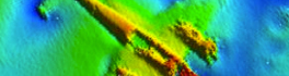
With the ocean covering a whopping 71% of the Earth’s surface, the ocean floor is largely unexplored. The benefits of knowing the landscape and contours of the ocean floor impact many different fields of study, […]
GAC 2015 Supports the GIS Education Community Everything begins and ends with geospatial information. Now more than ever, GIS and geomatics methodologies are gaining wide acceptance and adoption. GIS and geomatics tools were once […]
Check out the new “Photos” page on the GoGeomatics Magazine! Just look up and to the right on the MENU bar on this page! We’re posting pictures of our community members proudly wearing their GoGeomatics […]
The GoGeomatics Back to School Socials are taking place September 24th, 26th, and 27th. “These networking events are a fantastic way to meet and greet others in our industry,” says Jackie Woodruff, BC-based GIS Technician […]
This new online, interactive atlas, http://paninuittrails.org/index.html constructed from historical records, accounts, maps, trails and place names and visualized using innovative mapping technology, provides a unique window into the spatial extent and connectedness of Inuit occupancy, […]
GoGeomatics Canada is pleased to welcome Kirsti Oja to the team as our newest Edmonton Social group leader. She’s coming in at an exciting time. After hosting our first Edmonton social in May, we’re going […]
The report “Location Analytics Market by Software (Geocoding, Data Integration & ETL, Query, Reporting & OLAP Visualization), Applications (Marketing, Facilities Management, Risk Assessment, Tracking & Route Monitoring) – Worldwide Market Forecast (2014 – 2019)”, defines […]
Caliper is excited to announce a new Canada Data Package! The product includes a wealth of data and functionality not available in any other software. The Canada data includes an up-to-date street layer with address […]