Community
Ground Truthing
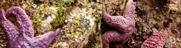
In the world of Remote Sensing, one of the key concepts is ground truthing. This has both a positional component, as well as a field verification of the land cover. These complementary activities are important […]
In the world of Remote Sensing, one of the key concepts is ground truthing. This has both a positional component, as well as a field verification of the land cover. These complementary activities are important […]
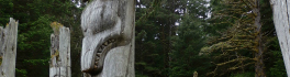
Haida Gwaii is a rich source for stories. There are many perspectives and many different formats. In the Haida culture there is the oral tradition. The first comprehensive versions of these stories were transcribed and […]
Over the past 20 years, oil and gas companies have used satellite earth observation technology through the entire project lifecycle, from pre-acquisition, to full operations and decommissioning. In 2010, the European Space Agency (ESA) began […]

The University of Victoria is partnering with the province to develop new ways of using airborne sensors to gather information about the environment and natural resources, including forest health, invasive plant species and mineral mapping. […]
*Editor’s note: Due to unforeseen circumstances, the speaker has been postponed for the April Social. The social is still taking place April 22, and we’ll be watching the hockey game as a group! We’re hoping […]

Students don’t need to be located in Nanaimo, British Columbia to get a post-graduate diploma in GIS applications from Vancouver Island University. VIU offers their Advanced Diploma in GIS Applications (ADGISA) in both Face-to-Face and […]
I work for Sight Surveillance. My day begins bright and early in the morning. After a hearty meal, I set out for a daily safety meeting. Each person in the room has a very different […]