tsunami mapping

Geospatial Canada Briefing Oct 19: 1. Tsunami mapping; 2. Re-forestation with drones; 3. Vinland Map; 4. Holographic Sonar Displays; 5. Flood mapping; 6. drones in search & rescue

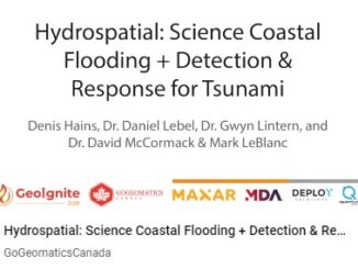
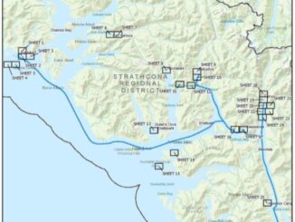
Tsunami mapping provides clearer picture of devastation for NW Vancouver Island A $1.2 million collaboration between five First Nations, four…

Hydrospatial

GeoIgnite 2020 Video : Hydrospatial – Understanding Coastal Flooding, Detection & Response for Tsunami

The GeoIgnite annual conference 2020 was power packed with discussions and presentations about compelling technologies, impressive scientific advancements and upcoming…

Your Canadian Geospatial Briefing for August 10th: Initiatives help youth address climate change; Mapping mask-mandatory businesses; Vancouver Island First Nations roll out tsunami mapping; COVID-19 mapping resource

Groundbreaking initiatives help Canadian youth address climate change Two Canadian charities are taking a stand and inspiring action against climate…