• facebook
  • Twitter
  • Linkedin
  • Youtube
  • Linkedin Group
  • Post a Job
  • Post an Ad
  • Post an Event
  • Post a Directory Listing
  • Post a Press Release
  • Media Kit
  • My Account
  • Login
GoGeomatics
  • MAGAZINE
    • BIM & GIS
    • Community
    • Conference news
    • Earth Observation
    • Education & Careers
    • GEOAI
    • Announcements
    • Reality Capture & Lidar
    • Science
    • Technology
  • Directories
    • ASSOCIATION
    • INDUSTRY
    • EDUCATION
    • Open Data
  • EVENTS
    • GeoIgnite Events
    • Events Calendar
    • GoGeomatics Meetups
  • Services
    • Advertising
    • Marketing
    • Post a Job
    • Post an Ad
    • Post an Event
    • Post a Press Release
    • Post a Directory Listing
    • Media Kit
    • Web Design
  • Find a Job
  • Volunteer
    • Start a GoGeomatics Group
    • Editors & Writers Group
  • About Us
    • About Us
    • Contact Us
    • Frequently Asked Questions
  • Videos
HomeUtility Mapping

Utility Mapping

||||
Technology

Rod Radar Introduces the First Ever Bucket Ground Penetrating Radar

9 August 2022 GoGeomatics Canada | excavating machinery

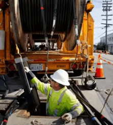
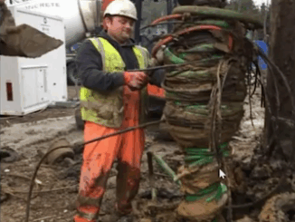
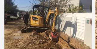
The Live-Dig Radar is Hailed as a “Game-Changer” Participants in the March 22, 2022, live stream presentation by Yuval Barnea, Vice President of Sales and Marketing at RodRodar, were witnesses to several firsts.  Barnea introduced […]

|||
Technology

Locusview Discusses the Importance of Optimizing Processes with Digital Management Tools

9 August 2022 GoGeomatics Canada | business values

Having a digital mobile workflow will help utilities as the infrastructure construction sector is booming globally.  Optimizing the asset booking process with digital construction management tools was the topic of the SUMSF, March 22, 2022, […]

||
Technology

Reduct NV Discusses Concept to Challenge Today’s Perspective on Gyro-Mapping

28 July 2022 GoGeomatics Canada | concept

Product-as-a-service can make Gyro-Mapping more affordable for all. Otto Ballintijn, CEO of Reduct NV, introduced Product-as-a-service (Paas) as a concept during a March 22, 2022, livestream at SUMSF. Reduct NV, a world leader in Gyro-Mapping […]

||
Technology

Geosystems France Discusses Initiative to Reduce Damage to Underground Utility Networks

18 July 2022 GoGeomatics Canada | 3D modeling

The DT-DICT Is Reducing Damages Patrice Lemire, Directeur General Geosystems France, was the keynote speaker for the March 22, 2022, SUMSF livestream. The topic of interest was “Reducing damage to underground utility networks with the […]

||||||||||
Technology

The SLA Presents Their Utility Mapping Ecosystem for Digital Workflows

26 June 2022 GoGeomatics Canada | 3D digital

Singapore is tapping into the potential of underground space. On March 23, 2022, participants of SUMSF were treated to a live stream presentation by Victor Khoo, Director of Singapore Land Authority (SLA). The topic of […]

||||
Technology

Geospatial Commission Demonstrates How To Apply Real Data To A Data Model

24 June 2022 GoGeomatics Canada | Amy Manefield

Preparation begins for NUAR rollout to selected areas. Amy Manefield, Head of Data Operations for the NUAR project sponsored by the Geospatial Commission, presented the topic of applying real data to a data model during […]

||
Technology

Lux Modus Shares the Effectiveness of Creating a 3D Infrastructure Digital Twin

23 June 2022 GoGeomatics Canada | 3D

 An infrastructure digital twin is possible now. SUMSF welcomed President of Lux Modus, Joseph Hlady, to speak on March 22, 2022. His livestream presentation was on creating a 3D infrastructure digital twin.  An Infrastructure Digital […]

|||
Technology

DGT Combines Traditional and Advanced Technologies to advance Unground Mapping

21 June 2022 GoGeomatics Canada | BIM

Best practices come from using radar tomography to augment underground utility locating. SUMSF live stream on March 23, 2022, treated participants to a presentation by Michael Twohig, Subsurface Utility Mapping with DGT Associates, and Mitchell […]

Posts pagination

« 1 2 3 »

Events

Notice
There are no upcoming events.

View All Events

Services

  • Post a Job
  • Post an Ad
  • Post an Event
  • Post a Directory Listing
  • Post a Press Release
  • Media Kit
  • My Account
  • Login

Jobs

Post a Job
  • Canada Maps and Poster Gallery Volunteer Leads — GeoIgnite 2026
    remote
  • GIS & Data Analytics Lead
    Beaumont, AB
  • Lead Surveyor, Projects/Arpenteur-géomètre principal, projets; arpenteuse-géomètre principale, projets
    North Bay, Thunder Bay
  • Senior GIS Developer
    Calgary, AB
View All Jobs
  • Directories
    • Associations Directory
    • Industry Directory
    • Education Programs
    • Open Data
  • Volunteer
    • Start a GoGeomatics Group
    • Editors & Writers Group
  • About Us
    • GoGeomatics Media Kit
    • Who We Are
    • Contact Us
    • FAQ’s
    • Advertising
    • Marketing
  • Subscribe
GoGeomatics
GoGeomatics is the largest and most popular communications hub promoting the Canadian geospatial community. The business was incorporated in 2011. GoGeomatics hosts over 100 fun, free, location technology networking events each year in cities across Canada.

© 2025 GoGeomatics

  • facebook
  • Twitter
  • Linkedin
  • Youtube
  • Linkedin Group