• facebook
  • Twitter
  • Linkedin
  • Youtube
  • Linkedin Group
  • Post a Job
  • Post an Ad
  • Post an Event
  • Post a Directory Listing
  • Post a Press Release
  • Media Kit
  • My Account
  • Login
GoGeomatics
  • MAGAZINE
    • BIM & GIS
    • Community
    • Conference news
    • Earth Observation
    • Education & Careers
    • GEOAI
    • Announcements
    • Reality Capture & Lidar
    • Science
    • Technology
  • Directories
    • ASSOCIATION
    • INDUSTRY
    • EDUCATION
    • Open Data
  • EVENTS
    • GeoIgnite Events
    • Events Calendar
    • GoGeomatics Meetups
  • Services
    • Advertising
    • Marketing
    • Post a Job
    • Post an Ad
    • Post an Event
    • Post a Press Release
    • Post a Directory Listing
    • Media Kit
    • Web Design
  • Find a Job
  • Volunteer
    • Start a GoGeomatics Group
    • Editors & Writers Group
  • About Us
    • About Us
    • Contact Us
    • Frequently Asked Questions
  • Videos
HomeWestern

Western

No Picture
Newsmakers & Press Releases

Seisland Surveys Wins Esri Canada’s Award of Excellence in GIS

28 May 2015 GoGeomatics Newsmakers | 2015

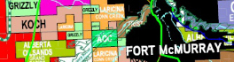
Cloud-based oil and gas information management solution supports effective emergency response CALGARY, Esri Canada User Conference – May 27, 2015 – Rapid access to asset information is valuable to companies in nearly all industries, especially […]

No Picture
Newsmakers & Press Releases

BlackBridge Networks and Cybera Bring Landsat 8 Imagery to Canadian Academic Institutions and Non-Profits

19 May 2015 GoGeomatics Newsmakers | 2015

Lethbridge, Alberta, May 19, 2015  - BlackBridge Networks and Cybera have made a new tool available that gives researchers easy access to Landsat 8 satellite imagery. The imagery download service will benefit Canadian not-for-profit organizations […]

No Picture
Newsmakers & Press Releases

City of Hamilton Revamps Online Engineering Records System Using Esri Technology

30 April 2015 GoGeomatics Newsmakers | 2015

New SPIDER system significantly increases speed and accuracy of document searches HAMILTON – April 30, 2015 – The City of Hamilton has launched a new online engineering records system that delivers significant efficiencies in locating […]

|
Community

tecconnect Making Lethbridge a Hub for Geospatial Technology

1 April 2015 GoGeomatics Canada | agriculture

How can we foster a strong geospatial sector in our cities and communities across Canada? Economic Development Lethbridge’s (EDL) answer to this question is tecconnect, a centre and incubator facility for new commerce that is […]

|
Community

GoGeomatics Survey Training Program & the Price of Oil

26 February 2015 GoGeomatics Canada | 2016

Back in December, we told you all about a new survey training program we were developing to retrain GIS graduates for a lucrative career in the field of land surveying in western Canada. This program […]

No Picture
Newsmakers & Press Releases

Brandt expands positioning technology offering into Atlantic Canada

6 February 2015 GoGeomatics Newsmakers | 2015

REGINA, Feb. 6, 2015 – Brandt Tractor is pleased to announce the expansion of their commitment to the growing Canadian positioning technology market through the acquisition of On Grade, Topcon Positioning Systems’ exclusive Atlantic Canada distributor. […]

Community

New Survey Training Program Offers Opportunities for Grads, Industry

29 December 2014 GoGeomatics Canada | 2015

GoGeomatics Canada is spear-heading a brand new Training Program that will provide opportunities for both geomatics graduates and the survey industry in Canada. The Survey Training Program is designed to train qualified candidates to work […]

||
Community

Divestco’s Approach in Mapping for Oil & Gas Exploration

13 November 2014 Ozair Khan | advice

Looking for oil and gas is big business in Western Canada, and like all important ventures it needs proper planning. A small investment in pre-planning in securing relevant maps, data, software, geomatics services and advice […]

Posts pagination

« 1 … 3 4 5 … 8 »

Events

Notice
There are no upcoming events.

View All Events

Services

  • Post a Job
  • Post an Ad
  • Post an Event
  • Post a Directory Listing
  • Post a Press Release
  • Media Kit
  • My Account
  • Login

Jobs

Post a Job
  • Canada Maps and Poster Gallery Volunteer Leads — GeoIgnite 2026
    remote
  • GIS & Data Analytics Lead
    Beaumont, AB
  • Lead Surveyor, Projects/Arpenteur-géomètre principal, projets; arpenteuse-géomètre principale, projets
    North Bay, Thunder Bay
  • Senior GIS Developer
    Calgary, AB
View All Jobs
  • Directories
    • Associations Directory
    • Industry Directory
    • Education Programs
    • Open Data
  • Volunteer
    • Start a GoGeomatics Group
    • Editors & Writers Group
  • About Us
    • GoGeomatics Media Kit
    • Who We Are
    • Contact Us
    • FAQ’s
    • Advertising
    • Marketing
  • Subscribe
GoGeomatics
GoGeomatics is the largest and most popular communications hub promoting the Canadian geospatial community. The business was incorporated in 2011. GoGeomatics hosts over 100 fun, free, location technology networking events each year in cities across Canada.

© 2025 GoGeomatics

  • facebook
  • Twitter
  • Linkedin
  • Youtube
  • Linkedin Group