
Community
Open Data, Open Source, Open Possibilities
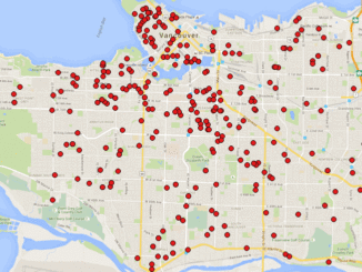
Back in 2006 I (Jim) was a student at BCIT and a Vancouver resident, eager to obtain some local data for a project. I sent a hopeful email to City of Vancouver (COV) requesting the […]
Back in 2006 I (Jim) was a student at BCIT and a Vancouver resident, eager to obtain some local data for a project. I sent a hopeful email to City of Vancouver (COV) requesting the […]
The conference committee of the GIM International Summit has announced a refreshing list of inspiring and original speakers who will give a keynote at the inaugural edition of the event. Among the confirmed speakers is […]
This week Turkish F-16s took out a Russian military jet along the Turkish-Syrian border. Turkey is a NATO member and any conflict with Russia could immediately trigger the collective defense clauses of all NATO members. […]
A friend of mine who volunteers with a girls’ softball team came to me with a request recently. “I have the addresses of all of the girls in our softball league”, she said. “I want […]
This article focuses on the process of creating a very out-of-date map in GIS. Lots has gone on since I posted Gettysburg: What Could Lee See? last summer. Technology continues to evolve at a dizzying […]
Elevation Web Services: Limitations and Prospects Elevation data is necessary for a wide range of geospatial applications such as creating relief maps and rendering 3D visualizations, deriving the slope and aspect of a geographic area, […]
An informal poll by Julia Meldrum Smith This article was reprinted with permission from the Ontario Professional Surveyor, Volume 56, No. 3, Summer 2015 A few years ago Blain Martin invited me to participate in […]
GoGeomatics Canada would like to announce Kingston, Ontario has been added to our growing list of cross-country GoGeomatics Socials! GoGeomatics welcomes Tristan Forward as the social group leader for Kingston. Which will be held at […]