This interview is part of a series of interviews spanning the depth and breadth of the Canadian GIS community. We are talking to GIS and geomatics instructors at colleges and universities across Canada. We’ve contacted over 20 instructors and professors in Canada and they are sharing not only the inside scoop on their programs but a little about themselves and the state of the art instruction in our field. Today we are in British Columbia talking to Rick Davidson one of the instructors of the Langara Open source GIS program Rick and his fellow instructor Jim have been written a series of articles that illustrate the power of open source GIS software. Lets’ dive into our conversation.
 Jonathan Murphy: Hi Rick thanks for talking to GoGeomatics about the Langara Open software GIS program. To get started we like to get to know who we are talking to. Can you tell the community a little about yourself? Where are you from and how did you get into GIS? Where did you go to school?
Rick Davidson: Hi, Thanks for the opportunity to talk about Open Source GIS, which is much more interesting than me!

My professional background is in Telecommunications, an industry I’ve worked in for many years throughout B.C. and Alberta. As a Telecom Technologist (NAIT, 1981), my work exposed me to Asset Management/Facilities Management (AM/FM) systems decades ago. As GIS systems became more cost effective they began to take over AM/FM functions in my industry. I noticed this trend and returned to school to learn more about GIS, graduating with an Advanced Diploma in GIS from BCIT (2002). I found myself fascinated by some of the Open Source projects such as MapServer and then explored the world of Free and Open Source Software (FOSS) quite extensively.
Jonathan Murphy: You work with Jim O’Leary sharing the work as instructors. Can you describe how you work together and what you each specialize in?
Rick Davidson: In 2014, I was back in school again, completing an M Ed. in Adult Education and Curriculum Development at Simon Fraser University. One of my papers, “Preliminary Planning for a Continuing Studies GIS Program”, served to kick-start a collaborative effort between Jim and myself. We researched, collected, and adapted FOSS curriculum resources from the Web and created the program that we now offer at Langara College.
Jim, who is more of an expert in GIS technology than I, created many lab exercises using data from Vancouver, the Province of B.C, and elsewhere in Canada. While Jim is the GIS wiz, I have tended to focus a bit more on research, academic concerns and quality control.
Overall, it has worked out that our skills and interests have been complementary. Currently, Jim is teaching in the program much more than I, since my primary career, designing fibre optic networks, has been rather hectic.
Jonathan Murphy: One of our favourite questions to ask GIS instructors is what was your first paid GIS job? What were you doing?
Rick Davidson: I’ve never had a full-time GIS gig, but have always tried to be the GIS evangelist and support person around the office. One early experience involved being on a Selection Committee that evaluated the enterprise GIS offerings numerous vendors were presenting to my employer. It was very interesting to observe and interact with the high-powered technical and sales experts from the major GIS vendors who were vying for the company’s business.
Jonathan Murphy: Where is your GIS program at today? is it still the only Open Source GIS program in Canada?
Rick Davidson: Our program is proceeding at a slow and steady pace. We haven’t been overwhelmed by the number of students attending, but we’ve been very pleased to see that we were right on point in determining what types of students would be interested in taking the program.
Our colleagues Tony Bonnici and Eva Snirer, experts in their respective fields, have been teaching two of our more specialized courses, Intro to Cartography (Tony) and Intro Remote Sensing (Eva). Contributions from these instructors have gone a long way towards strengthening the program.
Although we’ve heard of other schools using QGIS and other FOSS software in some of their courses, we haven’t been made aware of any other institutions offering a full certificate program using FOSS GIS.
Jonathan Murphy: Why is teaching open source GIS important?
Rick Davidson: GIS tools are powerful and can be very beneficial when used correctly. I feel that it is important to make this technology widely available (without onerous costs) to individuals, small businesses and community organizations.
Jonathan Murphy: Each student is different but certain concepts like datum’s and projections can be difficult to understand for novices coming to grips with GIS. It’s made all the more difficult as most GIS software now is a black box. Students don’t really know what is going on inside. They see results from buttons pressed. How do you introduce students to concepts like datum’s and projections so they get it?
Rick Davidson: The black box situation you describe is not necessarily a problem. Many people use complex technology effectively without really knowing what is going on inside the box.
For example, in one of our exercises we illustrate how badly distorted data can become when viewed in the wrong projection. Then we show what happens when the amazing “On The Fly Reprojection” (OTF) feature of QGIS is activated. Simple demonstrations like this go a long ways towards achieving understanding.
Bloom’s Digital Taxonomy, by Andrew Churches (2002), provides a Mind Map reworking the theories of Dr. Benjamin Bloom (1956).

In his Mind Map, Churches uses verbs such as using, executing, running, loading, playing, operating, sharing, and editing at the “Applying” level of the taxonomy. Applying a framework similar to this to, we have consciously designed the 5 18-hour courses in our program so that the highest order of GIS thinking skills we teach in the classroom are primarily at the Applying level.
We are teaching students from disparate disciplines how to apply GIS tools within their professions, where they should already be trained and functioning with higher order thinking skills.
Just as a carpenter does not need to know a huge amount about metallurgy or tool making to choose, use, and maintain carpentry tools, our students do not need to be capable of performing GIS business analysis, geospatial database design, and creators of complex GIS algorithms to apply GIS effectively.
For those who want to learn more about GIS, each set of classroom lectures, exercises and assignments is accompanied by an extensive amount of written text, with links to more in-depth material.
Jonathan Murphy: What type of student do you find is taking your open source GIS program and why?
Rick Davidson:The vast majority of our students are professionals who, like me, have noticed that GIS is used extensively in their industries. They want to be able to use the technology effectively without having to pay licensing fees for expensive proprietary software.
Some specific examples of the types of students we’ve seen in our classes:
- an academic trying to gain skills in using GIS for crime analysis
- an arborist who found themselves using GIS software at work to manage data about City trees
- a volunteer striving to help control an invasive plant species who wants to use QGIS for this work
- a community activist who wanted to map the accessibility of public walking trails
- nurses who were interested in how GIS is used in epidemiology
- a student majoring in GIS at another school who wanted to learn more about QGIS
- a professional reporter interested in being able to use GIS for journalism
Jonathan Murphy: Why do you feel it’s important that all professionals not just GIS professionals know QGIS.
Rick Davidson: GIS skills are very valuable to organizations, and having a software platform such as QGIS available goes a long ways towards eliminating barriers to getting GIS projects going. I look at it this way: I’ve seen very few job posting that ask for a high level of skill in using spread sheets, word processing, and simple database software, yet during my career I’ve noticed that employees who can use such software effectively tend to get noticed by management and assigned to projects that utilize their skills.
The most effective professionals are often those who have the best communication skills. As those of who are familiar with GIS know, a well-executed map is one of the most compelling and succinct methods of communicating information in numerous domains.

Jonathan Murphy: Have you seen the growth in interest from employers in having new hires have knowledge and experience of Open GIS software?
Rick Davidson: Although we haven’t done any quantitative analysis, I’ve noticed an significant number of online job postings mentioning QGIS. A current ad for a Geospatial Intelligence Engineer at Amazon, in its Basic Qualifications section, asks for “Experience with GIS software such as QGIS or ESRI”.
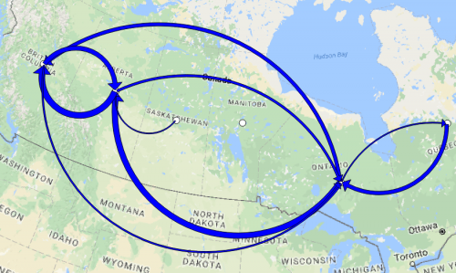
Jonathan Murphy: Langara has published a number of articles on GoGeomatics Canada showcasing the usefulness of open source GIS software. Published a year ago the article called Mapping Migration Flows with QGIS one of the most read articles on the GoGeomatics Canada magazine. Why do you think it’s so popular?
Rick Davidson: I think it is mainly because the software is so accessible and of such high quality. QGIS is free to download, relatively easy to get started with, very well documented and supported, and demonstrably very powerful.
Jonathan Murphy: We appreciate you taking the time to talk to GoGeomatics Canada and discussing your program. We look forward to seeing you and some of your students that the Back to School social in Vancouver this September.
Rick Davidson: Thanks again for helping us to get word out about our program. I enjoy the Vancouver Chapter GoGeomatics events and have the September 25th Vancouver GoGeomatics Back to School social on my calendar.


Be the first to comment