

Whether you’re using a traditional GIS (geographic information systems) software that is commercially available or developed by the open source community, many workflows still require outputs including production quality maps. While these traditional GIS platforms tend to be robust and capable of performing a large variety of geospatial mapping and analysis tasks, many lack an emphasis on map creation and design tools. This is where Avenza MAPublisher® and Geographic Imager® plug-ins for Adobe® Creative Cloud® come into play.
MAPublisher has been the standard map design solution for Adobe Illustrator® for more than 25 years, offering users GIS functionality in an ideal graphic design environment. Since 2005, Geographic Imager for Adobe Photoshop® has provided quick and easy spatial image editing tools in a familiar image editing environment. While traditional GIS software has offered users limited ability to manipulate the visual attributes (colours, transparency, line thickness, text, etc.) of geographic features, they have not empowered users to take it to the next level and create high-quality maps. Where do many users go from here? While many traditional GIS software do have the ability to export maps for use in another format, they do not reliably translate the geographic features and data. In contrast, MAPublisher and Geographic Imager both bridge the gap between the two worlds of GIS and graphic design software using a mapping engine that treats geographic features as any other graphic elements and includes data to relate the map to coordinates on Earth, all within the Adobe design workspace.
Empowering geomatics with design
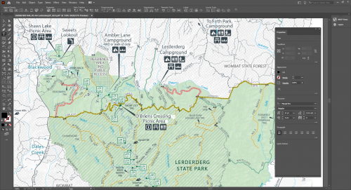
Geomatics professionals are faced with many challenges when working on a project including sourcing reliable data, cleaning the data, and manipulating the data to make it tell a story. Telling the story through visuals requires using data-driven design decisions to create an effective map. Geomatics professionals are tasked with presenting complex data in a way that synthesizes and communicates spatial patterns. For example, creating a thematic map using census data to visualize socio-demographic trends in an area. Even if the data was massaged in another software, MAPublisher has the ability to import the data into a workspace that supports both advanced geoprocessing capabilities as well as powerful design tools. You can see all the information assigned to a census unit and use the data to create maps that show a specific theme’s spatial variability. Since Adobe Illustrator and MAPublisher work together seamlessly, you’ll stay in the design environment to finish all of your map’s visualization.

Next step in the mapping workflow
Cartographers know the secret to making professional maps: it requires professional design tools. Bringing together complex geospatial data requires a mix of science, art, and specialized tools to get it right. While it is natural to move from a traditional GIS into an Avenza mapping product, it’s also important that many professionals are simply starting their mapping projects inside MAPublisher and Geographic Imager. Imported data maintains geographic properties and adds a “map awareness” where users can make unique design decisions using data-driven design tools. Geographic Imager considers any image a “spatially aware” as long as geographic data is accompanied with it or built into the file (like a GeoTIFF).

Many GIS applications offer an Adobe Illustrator export option, proving that Illustrator has long been the preferred work environment for making maps. However, these file exports don’t usually contain the geographic information required to make them useful, essentially turning them into static “map illiterate” documents. In recent years, Avenza has become a huge supporter of the geospatial PDF format and exporting into a geospatial PDF has provided users with another way to move their maps into other MAPublisher, Geographic Imager, and the Avenza Maps app.
Recent attempts by other GIS software vendors to address the increasing demand for cartography and map creation within the Adobe environment is evidence that making maps in Adobe Illustrator is the preferred way to go. With Avenza leading the way for more than 25 years, it is a workflow that is here to stay and evolve.
How to get MAPublisher and Geographic Imager
MAPublisher for Adobe Illustrator and Geographic Imager for Adobe Photoshop are both available as downloadable free trial. Alternatively, you can try MAPublisher and Geographic Imager visiting the Adobe Add-ons Marketplace, available to both Mac and Windows users.
Learn more through GeoIgnite
Avenza is a proud Silver sponsor of GeoIgnite and is presenting more during the Main Conference on April 23, 2021. In addition, Avenza is hosting a workshop session the following week on April 29, 2021 that will focus on a journey through the Avenza Maps platform.


Be the first to comment