
Drone company will convey COVID-19 medical equipment to First Nation
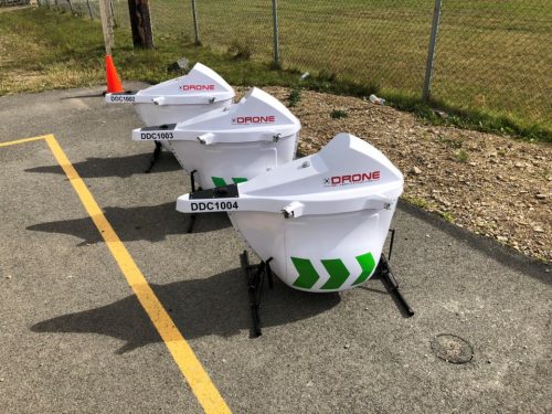
Drone Delivery Canada (DDC) will transport COVID-19 medical products using Sparrow drone to Beausoleil First Nation (BSN) community located at the southern tip of Georgian Bay north of Barrie, Ontario.
DDC’s services will start within the next three months in a first-of-its-kind agreement in Canada between DDC and Beausoleil First Nation.
Michael Zahra, president and CEO of DDC believes that the drone delivery solution will be helpful for the Beausoleil First Nation residents by reducing face-to-face interactions between mainland and Christian Island during COVID-19 pandemic.
https://www.northernontariobusiness.com/industry-news/transportation/drone-company-will-convey-covid-19-medical-equipment-to-first-nation-2411781
Montreal OPEN DATA: Unveiling of the new open data website
The City of Montreal has announced its new and interactive open data platform to make it easier for Montreal community to access and use datasets. More user-friendly, data visualization with interactive tools and API access for developers are some of the major differences between the new open data website and the old data platform.
There is a webinar on June 17th at 12 pm to learn more about the new open data platform of the city of Montreal: Register link: https://www.eventbrite.com/e/billets-presentation-du-nouveau-site-web-des-donnees-ouvertes-de-montreal-106978002084
Moreover, City of Montreal invites institutional organizations who work on the Montreal’s revival context to join its team as external partners.
https://donnees.montreal.ca/news/devoilement-nouveau-site-web-donnees-ouvertes
A tale of 2 leatherback sea turtles tagged off Nova Scotia
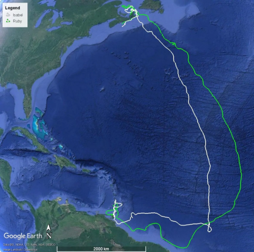
Isabel and Ruby, two leatherback sea turtles had been tagged off in July 2019 in Nova Scotia. They were carrying a tracking transmitter and an accurate GPS locations collector device through 12,000-kilometre migration from Canada to Trinidad island.
After 10 months, when two nesting leatherbacks came back to Trinidad island, their tags and stored data recovered by researchers and volunteers.
The data will be useful for scientists to reconstruct the movement of the sea turtles during their migration. Mike James, lead scientist with the sea turtle unit at Fisheries and Oceans Canada believes that scientists are aware of the threats to the turtles, interactions with local fisheries and human impact on them. They need data to better understand that.
https://www.cbc.ca/news/canada/nova-scotia/a-tale-of-2-leatherback-sea-turtles-tagged-off-nova-scotia-1.5580197
This Effort to Save Endangered Fish in BC Is Working
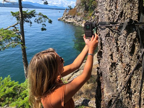
At least 37 Rockfish species are detected in British Columbia waters but many of them are in danger from overfishing in Galiano and other Gulf Islands of BC.
Between 2003 and 2007, Fisheries and Oceans Canada designated 164 federal rockfish conservation areas (RCAs) on the Pacific coast. However, it is not enough to save rockfish due to illegal fishing within RCAs.
In 2014, the Galiano Conservancy Association collaborated with the University of Victoria to launch a study to educate fishers and judge compliance with federal fishing regulations within three RCAs around the Galiano island. So they employed several cameras and posted information signs. The project helps reduce illegal fishing within the island’s RCAs .
Moreover, this team will work with Angler’s Atlas_an online resource of map, hotspots and boat launches for anglers_to expand its MyCatch app to show RCAs, give real-time alerts when fishers enter the boundaries, present regulations details and help identify rockfish.
https://thetyee.ca/News/2020/05/28/Effort-Endangered-Fish-BC/


Be the first to comment