InfraMappa Introduces Software to Assist Construction Planning and Execution
Construction companies are saving time and money by using a new software that enables them to view virtual sites.
On March 23, 2022, a live stream presentation by Moufid Charafeddine, CEO of InfraMappa, was held during SUMSF. He spoke on the topic of construction planning and execution with infrastructure mapping.
Charafeddine spoke about the changing world and infrastructure challenges. He gave a live demo of Inframappa software, as well as discussed the path to developing a digital twin.

Moufid Charafeddine, CEO of InfraMappa
Charafeddine said, “Stop guessing, start knowing.”
Statistics of underground infrastructure were shown. There are 240 000 pipe breaks per year, 400 fatalities since 2000, and $30 billion in damages to buried utilities annually. To change these statistics, InfraMappa has developed software to help.
Challenges faced by companies include difficulty accessing documents quickly, hard to identify problems in-field, slow access to resources in-field, breaking things, unable to quickly close valves in emergencies, and hard to share information.
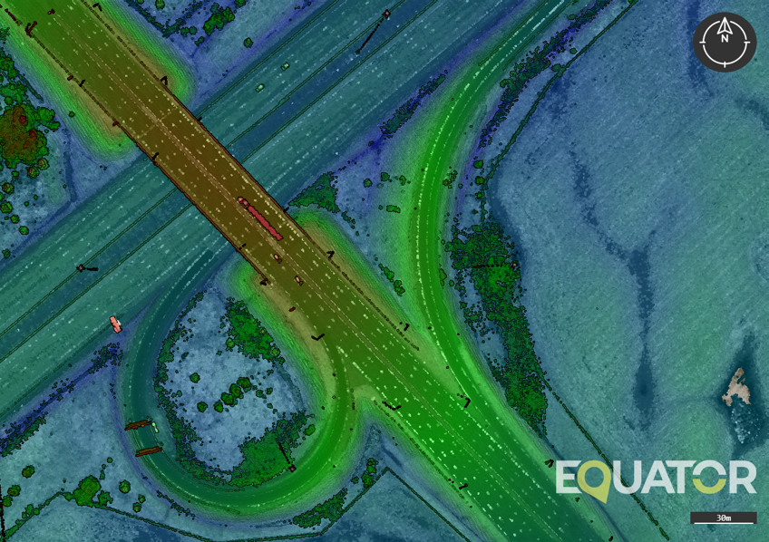
A live demo of Inframappa software, infrastructure, maps, apps, and analytics, showed how an image could be taken and made into a live presentation of assets. There could be one asset or several. InfraMappa is part of the OGC, Open Geospatial Consortium, so standards are followed.
The benefits of the software include avoiding planning mistakes, avoiding surprises above and below ground, and avoiding delays due to digging up surprises. Right now, the software has four million assets under management with thousands of users.
This system has precise data for budgeting, shows all layers for visualization, login for access, optimized for maintenance, construction preparation, and a mapping method subscription. Users have noticed several positive outcomes of this system, such as $5 million in grants, full on-boarded in under 40 days, and $200 000 in annual savings.
A deep, heartfelt thank you to InfraMappa, a Silver Sponsor for SUMSF, 2022 (The Subsurface Utility Mapping Strategy Forum).
An interesting Q and A session followed the presentation. You can watch the live-streamed presentation on Youtube below.