The ‘Geography’ of the Geospatial Profession
Independence
Geography, like time, breaks the rules of independence: observations across geography are going to vary. This is the first law of Geography: “everything is related to everything else, but near things are more related than distance things” (Tobler, 1970). 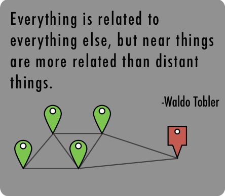
Geography is similar to time because just as you would expect rainfall averages of a municipality to be more similar to adjacent municipalities than ones far away, you would expect average rainfall in July to be more similar to June or August than to November or December. The former is known as spatial autocorrelation, while the latter is known as autocorrelation.
Both geography and time demonstrate the importance of dependence in observations – they help us understand how things are related. Identifying these relationships can help us understand why things are the way they are, and help us predict the way they might be.
Both geography and time have analogous variables to the professional world – an interesting thought is to see industries as geography, and technology as time. By seeing them this way we can determine what relationships exist between industries, between technology and industries, and how the geospatial profession is affected by those relationships.
The Profession Analogy
We can observe that the geospatial profession today is more similar to what it was 5 years ago than to what it was 20 years ago. This allows us to accurately predict that the profession will be more like today in 5 years than in 10 or 20. We can safely make this observation independent of industry. But is it safe to make this observation across industries?
If it was a rainier season in Vancouver, would you also say it was a rainier season in Toronto? Not necessarily, but you probably would infer that it was a rainier season in Victoria. If it was rainier in Toronto, would you say it was due to the same forces as Vancouver? You probably wouldn’t, but how could you be sure?
If the geospatial profession is burgeoning in transportation, is its growth commensurate in epidemiology? Not necessarily, but we might assume it is more similar in public utilities. If the growth was commensurate in epidemiology, is it due to the same forces that are driving growth in transportation and public utilities?
Indeed, the profession is not consistent across all industries. The place it has in any industry is best evidenced by the outcome of its displacement: what becomes of mining if you remove map-based claim staking, what becomes of rideshare programs without location-services on smart phones, what becomes of marine transportation without modern navigation technology, what becomes of agriculture without mapping and precision-guidance? Of course, the severity of each displacement varies and therefore the importance of the geospatial profession within it does too.
Needs as Near Forces
Before smart phones really took off in the late 2000’s, what stood before it? For decades the ingenuity of computer science and engineering helped steer the onset of the information age. And what stood before that? Alan Turing? What stood before Turing? Telegraphs? The history of the telecommunications industry is not an inevitable sequence of events though time, but a series of needs driven by context that occurred over time. In other words, time was the fertile ground for context, and context determined what the future would bring. This inseparable symbiotic relationship is unavoidable.
The succession of invention towards smart phones was driven by need – a need to communicate with political allies, a need to coordinate a network of people, a need to decipher coded messages, a need to expedite tasks. These are all needs that are strongly related by the need to communicate efficiently. Remove one, and perhaps the next one is prolonged, foregone, or manifests itself as a drastically different outcome. Therefore, these needs are ‘near’ to one another because they have so much in common. Needs are the forces that drive an industry.
Distant Lands
When the famous John Snow (known as the father of epidemiology) produced a map of cholera cases in London, one might be led to think that this spatial solution would serve as the foundation of public health. Indeed, public health today is constituted of many spatial services, but this is hardly the backbone of the industry. The needs of the industry are primarily focussed on statistics, bias, research methodologies, and an integration with medicine.

Original map by John Snow showing the clusters of cholera cases in the London epidemic of 1854
Similarly, the marine chronometer, sextant, and many other early survey instruments have been used for hundreds of years. They have had a profound effect on our modern world, but their uses were driven by other needs. Surveying instruments were used to divvy-up land and marine navigation technology to determine trade and exploration routes.
We can see the disparity in needs. This is evidenced by the path of the solutions. John Snow’s work led to a statistically-heavy, medically-focussed discipline, and the survey instruments sanctioned land delineation for owners rights and more efficient trade routes. Early epidemiology and traditional survey instruments don’t have much it common – it wasn’t the overwhelming need for highly accurate marine chronometers that put ‘GIS Analyst’ on health authority job boards.
The Point
Telecommunications and computing were the fertile ground giving these seemingly distant industries something in common. The local use of geospatial technology in each industry was driven by the needs of the industry. These local ‘near forces’ required geospatial technology insofar as the needs of their respective industry were met. As we know, technology, like time, brings on new possibilities, and with these new possibilities needs can be achieved in more efficient ways. This explains why the geospatial profession has ‘taken-off’ today – it’s easier to navigate with an onboard satellite navigation system than it is with a sextant and marine chronometer. It’s also more efficient to farm, find the nearest pizza shop, or measure arctic sea ice from year-to-year with geospatial technology. The geospatial professional is equipped to handle any of these tasks.
There are two things at play then, for the geospatial profession: the first is that the needs of an industry will employ whatever technology they can to achieve their needs. The second is that seemingly disparate industries (e.g. telecommunications, epidemiology, and marine navigation) can, over the course of time, affect one another when these needs are near enough. Globalization can tell us why.
We can accurately summarize globalization like this: it’s not that things become closer, it’s that things become less far. Land has never moved enough for us to call it closer to another spot of land, yet in less than 24 hours you can find yourself on any one of the continents. The needs of any industry are certainly dynamic and will change, but with respect to another industry, they are no closer to each other. Yet today the geospatial professional exists in both marine navigation and public health and a myriad of other industries. The geospatial profession is a multi-industry discipline that is both the product of, and a determiner of, industries.
What distant industry is beckoning from behind new possibilities, awaiting the arrival of the geospatial professional? What existing industry is awaiting a ripe solution to their evolving needs. I believe that the rules of geography and time can help us answer that if we look closely enough.
Postscript
More than anything this article is about provoking questions about how the geospatial profession relates to various industries. It’s especially pertinent with regards to the future. This article is largely focussed on isolating the profession at certain point in time (today), or isolating it in a specific industry. What it doesn’t consider is isolating the profession across industries across time. When the marine chronometer was invented it was a technological breakthrough – a real triumph of its time. This changed marine navigation forever. Similarly, the ‘unlocking’ of GPS by the US government was equally revolutionary. But are these instances identical and commensurate in their effects? Certainly all modern geospatial technology haven’t proven themselves to have the same effect as these momentous achievements, have they? My point is that the geospatial profession has seen great advances at different times in history and it may be worthwhile to weigh their importance to their time – there may be more to uncover!