Your Canadian Geospatial Briefing for May 6th: Nadine Alameh at GeoIgnite; Drone Delivery Canada; Inuvik Satellite Station; New Brunswick LiDAR data
GeoIgnite features plenary speaker from the OGC 
GeoIgnite is packing its schedule with plenary speakers who also happen to be leaders in the international geospatial community. Nadine Alameh of the Open Geospatial Consortium has recently joined the roster to lead various talks, including a keynote focused on how the Open Geospatial Consortium (OGC) community is championing innovation in a rapidly changing technology environment, and how this stance will impact location standards development, evolution and testing. Nadine is a successful entrepreneur with technical and business expertise, and she is bringing her passion for innovation and interoperability to GeoIgnite 2019. She will be joining Jonathan Murphy, Sanjay Kumar, Keith Masback, Amina Deiab, Bilyana Anicic, and countless more experts from business and government.
Drone Delivery Canada increases traction with new verticals
Drone Delivery Canada (DDC) is expanding its operations by adding eight business verticals, including Healthcare, Pharmaceuticals, Oil & Gas, Mining, Agriculture, Forestry, Construction and Courier Companies. To promote this expansion DDC has released a video focusing on its commercialization, highlighting the need for the areas that DDC has chosen to pursue. Says Michael Zahra, VP of Operations & Strategy at Drone Delivery Canada, “The opportunities in front of us are not only with the many Canadian First Nations & Inuit remote communities, but also with a broad range of government, commercial and industrial applications globally.” DDC is seeing an increase in traction with global customers as their drone delivery system continues to be a viable infrastructure solution to companies eager to reduce cost and improve logistics.
GeoIgnite poised to enter the Canadian geospatial scene 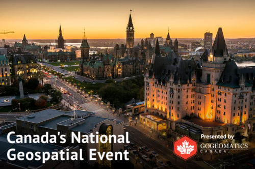
GISuser is helping us spread the word on the GeoIgnite conference by publishing this excellent article detailing the event’s place within the Canadian geospatial landscape. The importance of having a national vendor-neutral event can’t be understated; GeoIgnite is focusing on the critically important roles played by location technology in data, applications, technology, and services play across every sector of the economy in the ongoing global technology revolution. Participation from the government is expected to be high, with confirmed speakers from Natural Resources Canada (NRCan) and other federal departments. GeoIgnite is opening a unique window into the Canadian geospatial community, including a showcase of impressive innovations and leadership in geospatial technology.
SSC expands in Inuvik
The Swedish operation SSC is expanding its data reception capabilities at the Inuvik Satellite Station Facility (ISSF) with the help of Natural Resources Canada. This next step in the collaboration between SSC and NRCan will result in more customers accessing Earth Observation data thanks to the installation of new infrastructure. As well as expanding data reception and TT&C capabilities at the ISSF, the new infrastructure will also extend the “KINUVIK” solution of polar coverage. Prashant Shukle, Director General, Canada Centre for Mapping and Earth Observations at Natural Resources Canada, says “The addition of new SSC infrastructure at the ISSF is another step towards building the ISSF as a global Earth Observation destination. We look forward to continued collaboration on complementary activities that benefit Inuvik and, Sweden and Canada.”
New Brunswick releases open source LiDAR data 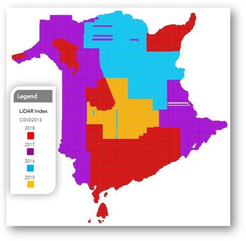
New Brunswick has become the first Canadian province to achieve complete aerial LiDAR coverage under an open data license by releasing their 2018 LiDAR data for public download. The aerial LiDAR collection completed by the Government of New Brunswick includes over 100,000 files and totals 7.2 terabytes of compressed LAZ files. Beginning in 2015 the entire province was covered, with data collected at 6 points per square metre; bare earth digital elevation model files are still being processed but some are already available for download. More details on downloading NB’s lidar data can be found by following the links within the article.