• facebook
  • Twitter
  • Linkedin
  • Youtube
  • Linkedin Group
  • Post a Job
  • Post an Ad
  • Post an Event
  • Post a Directory Listing
  • Post a Press Release
  • Media Kit
  • My Account
  • Login
GoGeomatics
  • MAGAZINE
    • BIM & GIS
    • Community
    • Conference news
    • Earth Observation
    • Education & Careers
    • GEOAI
    • Announcements
    • Reality Capture & Lidar
    • Science
    • Technology
    • Between the Poles
  • Directories
    • ASSOCIATION
    • INDUSTRY
    • EDUCATION
    • Open Data
  • EVENTS
    • GeoIgnite Events
    • Events Calendar
    • GoGeomatics Meetups
  • Services
    • Advertising
    • Marketing
    • Post a Job
    • Post an Ad
    • Post an Event
    • Post a Press Release
    • Post a Directory Listing
    • Media Kit
    • Web Design
  • Find a Job
  • Volunteer
    • Start a GoGeomatics Group
    • Editors & Writers Group
  • About Us
    • About Us
    • Contact Us
    • Frequently Asked Questions
  • Videos
Home2017June

Month: June 2017

||||||||||
Education & Careers

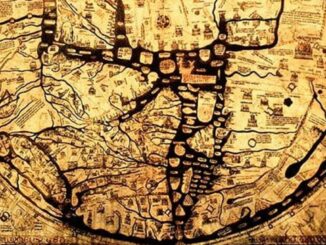
Cartography & Art: Historic and Ancient Maps

25 June 2017 Manminder 'Meena' Kaur | ancient cartography

As much a science as an art; cartography makes one wonder how the artist or mathematician-cum-geographer captured the most finite of cartographic details. Ancient maps are fascinating and inspiring. In this article I will discuss […]

Two way arrows||Flowmapper default arrow style||Buffers at ends of arrows||Arrows themed by magnitude of flow|Polygon centroids tool|Provinces|Flow type Two Way||Flowmapper with flow type NET
Technology

Mapping Migration Flows with QGIS FlowMapper Plugin

23 June 2017 GIS Program Langara CS | Canada

Flow mapping is a technique to visualize movement of objects of interest between geographic areas. Typical uses of flow maps could be traffic volume, trade balances, or migration. In this article we create flow maps […]

|||||
Community

Dr. Bob Ryerson on GoGeomatics Canada’s Past, Present, and Bright Future

19 June 2017 Robert Ryerson | Bob Ryerson

It is hard to believe that six years has gone by and over 1000 articles have been provided by GoGeomatics, but that is the case. I am honoured to have been one of the first […]

3D data

The other half of the laser scanning revolution in construction

17 June 2017 Geoff Zeiss

I have already blogged about the Leica BLK360 whose size, capabilities, one button operation and price point promise to revolutionize professional scanning for construction.  Anyone who has used a Leica scanner is familiar with Cyclone […]

3D data

Industry standard tools for underground utility detection and mapping

15 June 2017 Geoff Zeiss

At HxGNLive in Las Vegas this week I attended a session on using Leica technology to locate underground assets presented by Brett Black, GIS Solutions, Simon Pedley, Utility Detection Solutions and Mike Baker, G/Technology Product […]

3D data

Practical BIM/laser-scan round tripping on construction projects

15 June 2017 Geoff Zeiss

At HxGNLive in Las Vegas this week a very interesting presentation with practical implications for anyone involved in construction, whether buildings or horizontal infrastructure was provided by Stanley Lawrence, Reid Flamm, and Michael Moore of […]

||
Community

Canadian Geospatial Leadership: Lisa-Jen Edmonton GoGeomatics Group Leader

15 June 2017 LJ | edmonton

GoGeomatics Canada is catching up with one of our amazing volunteers in Edmonton. As a grassroots volunteer-led movement GoGeomatics strives to provide all sorts of opportunities to our community. One of those opportunities is a […]

Between the Poles – The Geoff Zeiss Archives

Monitoring integrity of water networks with satellites

14 June 2017 Geoff Zeiss

I am at HxGNLive in Las Vegas this week.  One of the several very interesting presentations with important implications for a number of industries is a talk by Massimo Zotti of Planetek.  He described an […]

Posts pagination

« 1 2 3 »

Events

Mar 31
March 31 - April 1

Geo Connect Asia 2026

Mar 31
8:00 am - 6:00 pm

Kootenays GoGeomatics Meetup in Nelson BC

Apr 13
5:30 pm - 7:30 pm

GoGeomatics Regina Meetup

Apr 21
6:00 pm - 8:00 pm

Calgary GoGeomatics April Social

Apr 22
April 22 - April 23

11th Annual Digitalization & AI in Energy Canada Conference

View Calendar

View All Events

Services

  • Post a Job
  • Post an Ad
  • Post an Event
  • Post a Directory Listing
  • Post a Press Release
  • Media Kit
  • My Account
  • Login

Jobs

Post a Job
  • Operations Spatial Data Assistant (Contract)
    Vaughan
  • GIS Analyst
    Saint John, New Brunswick
  • GIS Student Intern
    Elmsdale, Nova Scotia
  • Canada Impact+ Research Chair – Professor (Or Associate Professor)
    Lethbridge, Alberta
View All Jobs
  • Directories
    • Associations Directory
    • Industry Directory
    • Education Programs
    • Open Data
  • Volunteer
    • Start a GoGeomatics Group
    • Editors & Writers Group
  • About Us
    • GoGeomatics Media Kit
    • Who We Are
    • Contact Us
    • FAQ’s
    • Advertising
    • Marketing
  • Subscribe
GoGeomatics
GoGeomatics is the largest and most popular communications hub promoting the Canadian geospatial community. The business was incorporated in 2011. GoGeomatics hosts over 100 fun, free, location technology networking events each year in cities across Canada.

© 2026 GoGeomatics

  • facebook
  • Twitter
  • Linkedin
  • Youtube
  • Linkedin Group