Education & Careers
GoGeomatics Toronto and Vancouver Career Event Update – COVID-19
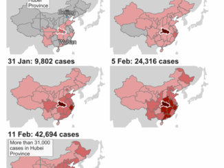
The health and wellness of our community deserves our utmost care and attention. GoGeomatics Canada continues to monitor the global health situation Coronavirus/COVID-19 and has decided on a contingency plan for our upcoming Vancouver and Toronto Career Events. Our main priority your health and well-being. […]