Canadian Cartography: GoGeomatics Edmonton Visits the University of Alberta Map Library & Collections
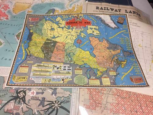
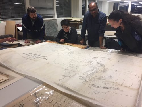
Last night the Edmonton GoGeomatics Group had the chance to explore the amazing collection of historic maps at the University of Alberta (U of A). Larry Laliberte, the U of A GIS Librarian, introduced the group to the libraries’ archive as well as sharing his expert knowledge of map making, GIS, and map documentation.
Edmonton group Leader Lisa-Jen Ferrato at this to say about the event:
Last night was a lot of fun and a great learning experience for the entire Edmonton GoGeomatics group. Larry is a fount of cartographic information and it’s clear he is passionate about cartography and the evolution of map making. We were able to see design plans of Edmonton that did not make it through development from the early 1900s. Larry also showed us a medieval map of Europe, Asia, and Africa. We saw railway maps that illustrated the race to expand into the Canadian West.We also learned about a couple projects the map library is working on that will make printed maps more accessible to its users by digital tables.
GoGeomatics Canada thanks the University of Alberta Map Library and especially Larry Laliberte for taking the time to show us this incredible collection of maps and Canadian history.
You can join the GoGeomatics Edmonton group at our next social in November by visiting our Meetup Page. The next free social is on November 17th at the Metro.






what you share really great and helpful for me!