International Geospatial Briefing for August 22nd, 2022
- Mapping Earth’s deepest points, the collision of Geology and Geospatial
- ISS to get a new hyperspectral remote sensing lab
- A new interactive map illustrates the history of shark attacks
- Tracking wildfires and droughts worldwide with geospatial tools
- Meet the Israeli company tracking carbon absorption to fight climate change
The historic trip to Challenger Deep with ESRI’s chief scientist
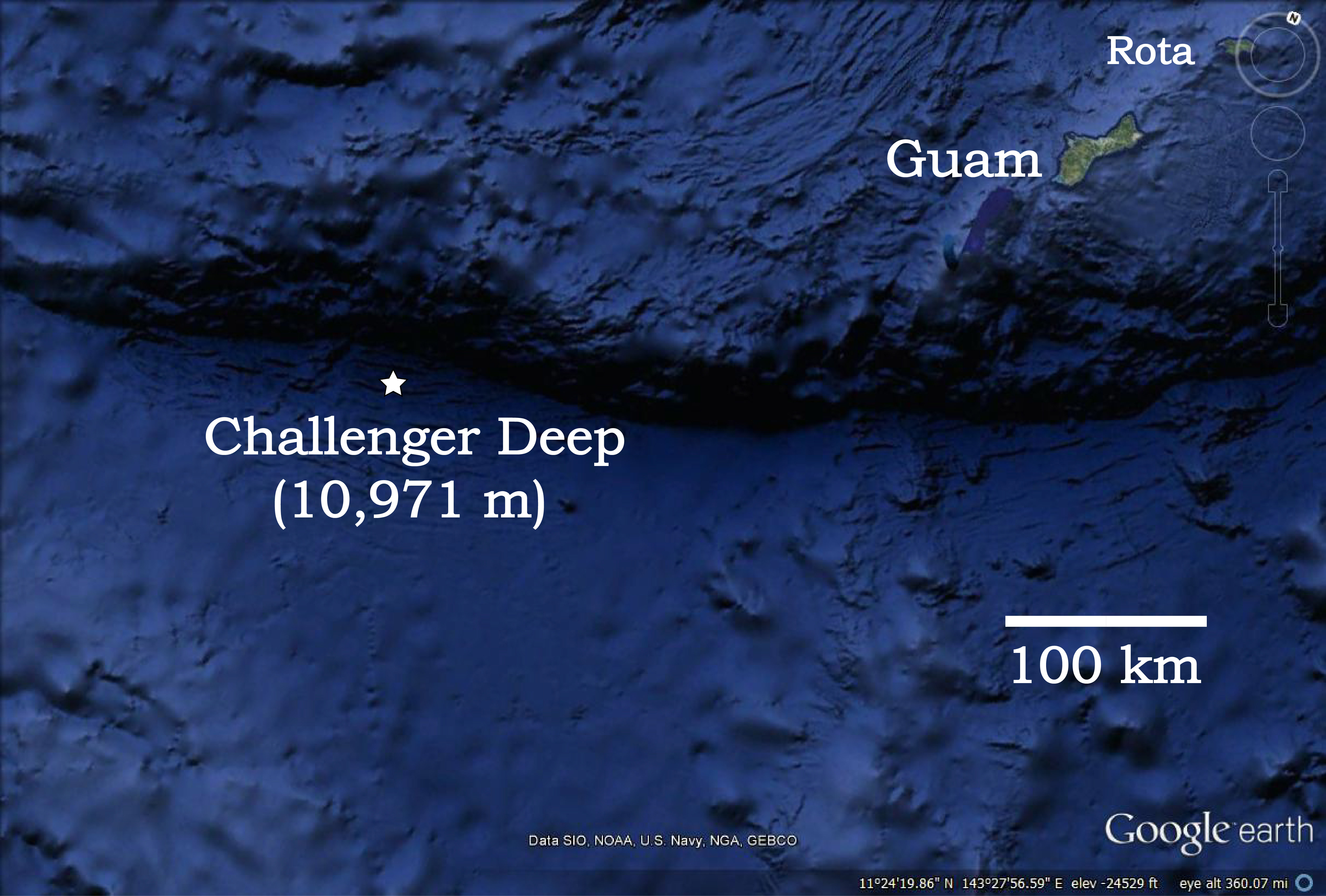
In July, Dr. Dawn Wright, a marine geologist, and chief scientist at ESRI descended more than 35,000 feet below the surface of the ocean to the deepest known point on the planet. Challenger Deep, a region of the Mariana Trench, has been the focal point of scientists like Wright for decades as they have worked to explore and map “its dark, strange depths”. With less than 25% of the ocean having been surveyed to modern standards, missions like the one in which Dr. Wright participated in are of great significance.
Seabed 2030 is a United Nations project that aims to produce a publicly available map of the world’s entire seafloor by 2030. With geospatial technology playing a key role in this mapping, Dr. Wright demonstrated these abilities as she helped to create detailed contour maps of the region, she visited using a custom side-scanning sonar and was the first to operate this system at such a depth. To learn more about this historic mission, check out the full article from Popular Science.
ISS to get a new hyperspectral remote sensing lab
A new joint venture between remote sensing analysis firm HySpeed and computer vision specialists Metaspectral is going to result in the International Space Station getting an upgraded hyperspectral remote sensing lab. The system, Onboard Programmable Technology for Image Classification and Analysis, or OPTICA for short, will allow the ISS to perform compression, streaming, and analysis of hyperspectral data in real-time from low Earth orbit.
Scheduled for launch in 2023, the OPTICA system will be deployed for six months onboard the ISS. Using data compression and machine learning to overcome bandwidth constraints will allow for more effective downlinking of the hyperspectral data to Earth for analysis. To learn more about the OPTICA system and what this hyperspectral capability on the ISS means for the future of space- and ground-based imaging, check out the full article here.
A new interactive map illustrates the history of shark attacks
The University of Florida has released a new, interactive map detailing shark attacks around the world. Using data from 1900 to the present, the team has created an effective visual interface that allows users to slide through time, sort the data by shark type known, as well as a filter between fatal and non-fatal attacks. The data for the map is from the International Shark Attack File (ISAF), which is the world’s only documented, comprehensive database of known shark attacks. To learn more about the interactive map, check out this article from Daily Mail, or explore it for yourself here.
Geospatial tools tracking wildfires and droughts around the world
As wildfires continue to play an ever-expanding role in summer news headlines around the northern hemisphere, there is a growing list of geospatial tools and platforms working to track and understand their spread. From Europe to Argentina to Canada, these wildfires are wreaking havoc as they become larger, more deadly, and more frequent. Some of the spatially driven platforms are hoping to provide a clearer picture of what is happening, from local regions to globally. ESRI has recently published a story map, Discovering Patterns in Global Wildfires, that project leader Dan Pisut hopes can help distinguish actual patterns from perceptions.
Where the causes of these wildfires can be determined they range from lighting strikes to arson to drought, the latter being of worry,” as summers become hotter and some areas receive less rain, drought-induced wildfires will also become more common and more severe.” Drought conditions are monitored constantly across the continental US by joint efforts from government agencies in hopes of understanding the changing landscapes while also mitigating risk in the most severely affected areas. Click the links above to explore some of what is being done to monitor droughts and wildfires worldwide.
The Israeli company tracking carbon absorption to fight climate change
Using satellite-mounted sensors, Albo Climate hopes to understand our most significant assets for carbon absorption in the fight against climate change. In the drive to create a global carbon credit system, identifying these regions of most significant absorption would allow local landowners and governments to sell offsetting carbon credits to polluters and emitters. By using machine learning, they can teach their tech to combine satellite imagery with real-world information that can generate pattern recognition from known absorption regions and apply it to other areas worldwide. Aiming to improve greatly on previous efforts to quantify carbon in this way, the team hopes to create maps with a resolution of 50cm squared per pixel. While most of the work done so far has been with land-based regions, the company hopes to be able to offer ocean-based solutions as well soon. Read the full story here to learn more about Albo Climate and what they hope to achieve.


