Canadian Geospatial Digest for March 25th, 2024
- How Indigenous companies are bringing high-tech solutions to the forest sector
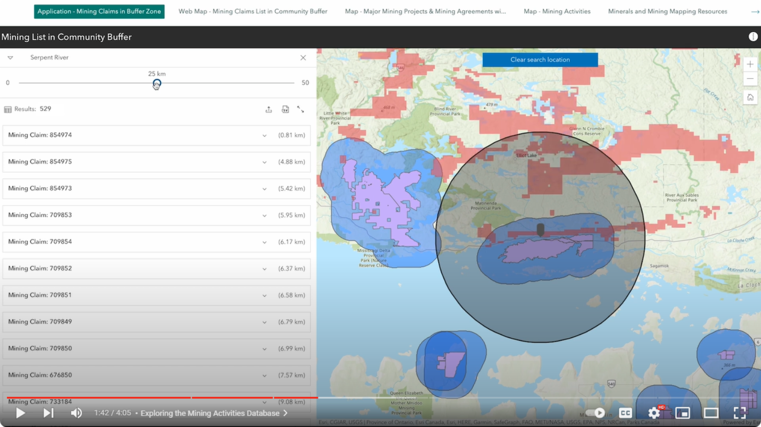
- GIS in Mining: Strengthening Indigenous Communities
- Flood risk mapping and public resistance in Canada
- Showing significant loss of affordable rentals in low-income Halifax neighbourhood
- More than 100 wildfires still burning in the middle of winter
How Indigenous companies are bringing high-tech solutions to the forest sector
Jacob Taylor, CEO of Indigenous Aerospace, aims to encourage Indigenous youth to explore exciting career opportunities in Canada’s forest sector. Indigenous Aerospace operates drones, provides drone education, and collaborates with the forest industry and Indigenous communities to demonstrate how drones can be used for mapping, monitoring, and managing forests. Indigenous Aerospace is showcasing how this technology can further support the sustainability goals of the forestry sector and Indigenous communities.

Drones assist in forest mapping. Source: The Globe and Mail
The article can be viewed here
GIS in Mining: Strengthening Indigenous Communities
This article explores the potential of using ArcGIS tools for First Nations communities, focusing on the Anishinabek First Nation. First Nations have embraced new GIS tools to assist in the mining sector, including the Mining Information application supported by Esri Canada and the Esri Advantage Program. These solutions can improve land stewardship and data sovereignty by customizing GIS solutions to meet the specific needs of the community. Additionally, ArcGIS Survey123 is useful for gathering data on land utilization and protected areas. ArcGIS StoryMaps is also a useful tool that shows results and improves accessibility, making it easier for people to explore different aspects of mining. This enables communities to access more up-to-date information, helping them make informed decisions and find sustainable solutions.

The Anishinabek Nation’s Mining Database. Source: Esri Canada
The article can be viewed here
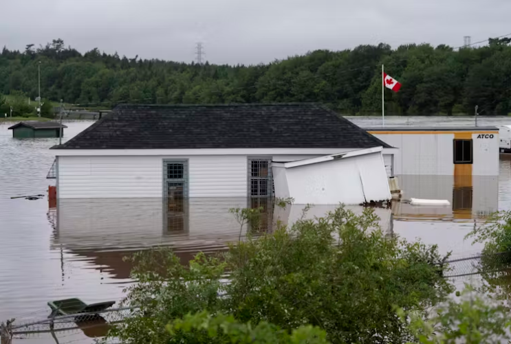
Flood risk mapping is a public good, so why the public resistance in Canada? Lessons from Nova Scotia
The 2023 Canadian budget includes a commitment to create a public flood risk mapping portal, as flood risk maps are generally seen as a public good. However, many parts of the country still lack comprehensive municipal and provincial flood risk maps. One reason for this might be the resistance from the public, leading to the withdrawal or modification of flood maps in response to public pressure. This article focuses on flood mapping in Nova Scotia, a province that is experiencing some of the most significant sea level rise in the country. A survey revealed that one of the main reasons for resistance to flood mapping is the potential impact it could have on real estate values in flood zones. The pushback against flood mapping in Nova Scotia reveals the complex link between public perception, the impact on real estate values, and the need for accurate flood risk information.

Halifax after a major rain event. Source: THE CANADIAN PRESS/Darren Calabrese
The article can be viewed here
New analysis shows significant loss of affordable rentals in low-income Halifax neighbourhood
A new mapping tool is highlighting the decrease in affordable housing in Calgary, Toronto, Montreal, Halifax, Vancouver and Winnipeg. The Canadian Centre for Housing Rights collected data to create a low-end of market rental housing monitor, examining factors such as evictions, housing costs, and vacancy rates. This article focuses on the Spryfield neighbourhood in Halifax, Nova Scotia, showing that it has experienced some of the greatest loss of affordable housing in the region. Between 2016 and 2021, about 39% of affordable single-person rental units in Spryfield were lost.


Estimate percentage of affordable private market rental units (1-person households) from 2020-2022 with Spryfield highlighted Source: Low-end of Market Rental Housing Monitor
Article can be viewed here
It’s the middle of winter, and more than 100 wildfires are still smouldering
Canada is currently experiencing a drier than normal winter, which is contributing to ongoing wildfires in Western Canada. As of now, there are 92 active wildfires in British Columbia, 54 in Alberta, and a few in the Northwest Territories. Research suggests that winter wildfires are becoming more common due to climate change and are expected to pose additional challenges in the spring.

Map showing active wildfires in BC and Alberta as of February 20, 2024. Source: CBC News
The article can be viewed here


