A new app from U of T researchers allows users to track their neighbourhood’s environmental health
Researchers at the University of Toronto have created a new app that provides insights into the environmental health of neighbourhoods. The project lead, Jeffery Brook, is an assistant professor with the Dalla Lana School of Public Health. He emphasizes the app as a tool to identify what makes a neighbourhood healthy, such as walkability, air quality, urban heat, and greenery, among others. The researchers are hoping to identify factors that lead to inequities amongst environmental health of neighbourhoods. The hope is that these insights will lead to better decision making for urban planning and an overall assessment of community environmental health. For more on how the team plans to use AI and machine learning to maximize the usefulness of the app, click here.

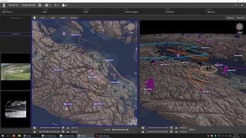
Beyond Visual Line of Sight drone operations getting safer with Kongsberg Geospatial new “Horizonless Air Picture”
Safe operation of drones often depends on what happens when you can’t see the UAV. Many familiar with this know it as Beyond Visual Line of Sight operations. Operators must be aware of air traffic and other UAV’s, and able to avoid these obstacles. Kongsberg Geospatial of Ottawa, with their partners Aireon and uAvionix hope to demonstrate their new “horizonless air picture” expanding the region of awareness of operators flying these craft. For more on this story, check it out here.

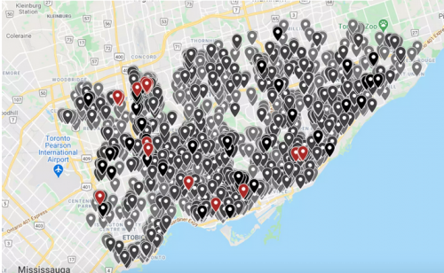
Track the mass eviction crisis happening across Toronto with the new map from Evictions Ontario
The financial hardships many people have experienced due to COVID-19 shutdowns have led to a slew of evictions across the province. Many experts and tenants across Ontario have recently called this out as an ongoing eviction crisis. While there was a moratorium on evictions for some time, the number of cases before the Landlord Tenant Board in Toronto has spiked over the last few months. Evictions Ontario has created a new interactive map to visualize the scale of these evictions. For a city already experiencing a dire homelessness crisis, an extended moratorium has been suggested, with many experts calling to halt these evictions. However, landlords are still able to seek eviction orders. The map identifies addresses with eviction hearings across the city, identifying them by the number of hearings scheduled per address. For more on this ongoing situation, click here.

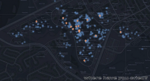
Mapping where people cry on the University of Waterloo campus
The pandemic has amplified stress in already stressful situations for many students across the world. Two students at the University of Waterloo wanted to create a sense of community and support for those going through struggles. They built a map of the places that people have cried to demonstrate that crying on campus is a shared experience. They want people to know that they are not alone and that everyone is going through something in hopes of creating a community of support and understanding. They received an overwhelming response with over 300 people sharing their stories. People shared where and why they had cried on campus recently. Reasons varied from sadness to anger to happiness and many things in between. In a time of stress, with many regions in various stages of lockdown, this community map offers a sense of connection and support to many students at the University of Waterloo. For more on this story, check it out here.

Canadians can begin signing up for Space X Starlink satellite internet – depending on where they live
As Elon Musk’s SpaceX continues to expand it’s satellite internet offerings through the newly introduced Starlink company, Canadians in remote locations can apply to connect to the service. Long hailed as a promising solution for achieving connectivity in many locales without the infrastructure to support high-speed internet, Starlink is seen by many as a solution to bring many of these communities online. Canadians are now beginning to connect to the service, but only if they live in the right location. Starlink is not a cheap option at 129$/ month plus the initial cost of the satellite dish at 649$. Residents of Pikangikum First Nation in northwestern Ontario have achieved incredible speeds of 144mb/s. While the website says that service should be available to all residents within the specific latitude and longitude coordinates within Canada, it also asks for the input of customers exact locations as a part of the sign-up process. To read more, click here.


Be the first to comment