As this is my first article with GoGeomatics Canada, I would like to start off by saying a warm hello to the readers out there who enjoy everything GIS related.
To give you a brief background of myself: I am a Geospatial Management Professional, with a strong interest in using GIS to solve real world problems. I have a particular, personal interest in the environmental field, as well as any field utilizing GIS to create a positive impact on the environment and human health. I hold a Bachelor of Science in Physical Geography, a Post Graduate Degree in Geospatial Management, and over five years’ experience utilizing various GIS software.
In this article I will be providing a glimpse into Esri Canada’s User Conference, held in Toronto on October 16th and 17th, 2012 in the North Building of the Toronto Congress Centre. This conference is held annually and brings in over 700 GIS professionals for a series of presentations, demos and networking opportunities. The first day of the conference is dedicated to showcasing a series of presentations and seminars which highlight the positive contributions of groups and individuals to the GIS community, as well as a Solutions Expo put on by a variety of vendors. The second day focuses specifically on technical seminars designed to impart specific knowledge about Esri products. The cost of the conference varies depending on the day that you plan to attend. To attend the first day costs $105, but you can save a little money if you are a student or signed up for the early bird price of $80. The second day consists of two technical seminars, each at a cost of $150.
About the User Conference
I attended the first day of the conference and had a very positive experience. For those who have not been to Toronto Congress Centre, it is an elegant venue featuring large, spacious halls, a number of seminar rooms, and beautiful décor. The attendees of the User Conference are an array of GIS practitioners, department and project managers, educators and trainers, application developers and decision makers in the GIS field. There are also many GIS related, industry vendors that come to showcase products or garner interest in the GIS work that they are involved in.
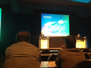
The day began with a series of presentations by Esri Canada’s President Alex Miller and Esri employees who showcased the new functionality of ArcGIS 10.1. The presentations continued through the morning and delved into topics such as the movement from desktop applications to various mobile platforms, new trends in 3D mapping, advancements towards GIS in cloud, and the importance of providing on demand content over any platform. Demos were given on using GIS to transfer government data in a meaningful way to the public in useful, up to date maps; bringing live maps into Microsoft Suite applications through Esri’s mapping servers and EsriI’s City Engine; a new 3D modeling software for Urban Environments. The morning presentation concluded with an award given to a GIS student who went above and beyond when creating a mapping application that looks into the most appropriate area to develop a new ski resort on the Niagara Escarpment.
Luncheon & Solutions Expo
An expansive buffet lunch is included in the ticket price for the event. The luncheon is an excellent opportunity to meet and network with many GIS professionals, and the food provided was delicious and plentiful. The variety of dishes including chicken, salmon, roasted potatoes, and much more, you have to be careful to leave room for delicious deserts like cheese cake and a variety of baked goods.
The tail end of lunch is a perfect time to visit the various vendors at the conference.
A few of the notable vendors at the event were:
- Avenza Systems Inc. – Provides powerful map-making software for the Adobe Creative Suite: MAPublisher for Adobe Illustrator and Geographic Imager for Adobe Photoshop.
- Geocortex – Software by Latitude Geographics that helps to accelerate and enrich the process of designing, building and maintaining ArcGIS for Server applications.
- Halltech – A company that works closely with clients and partners to achieve tailored, mobile GIS solutions.
- Environics Analytics – A premier marketing and analytical service company that specializes in segmentation, site modeling and custom analytics to provide data driven market insights to help clients find and keep their customers.
- Voyager – A GIS Data Discovery software that brings the simplicity of Web-style searches to GIS, allows a user to create a searchable catalogue of your data.
- URISA-OC (Urban and Regional Information Systems Association) – A premier, non-profit organization for the use and integration of spatial information technologies to solve challenges in government agencies and improve the quality of life in urban and regional environments. Events by this group provide a unique meeting opportunity for public and private geospatial professionals to network, share experiences, and build collaborations.
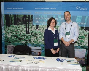
- Land Information Ontario – Provincial Government body that provides access to public geospatial data about Ontario, free of charge, through the utilization of a number of free tools and services.
Concurrent Esri Canada Technical Sessions
The afternoon of the conference was filled with break out presentations and technical sessions put on by various organizations.
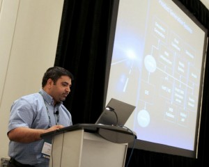
Pelmorex Media Inc./ The Weather Network –Create Once, Publish Everywhere: GIS and Multi-Platform The first presentation I attended was by Dr. Pat Pellegrini and Jim Saini from Pelmorex Media Inc./ The Weather Network. I found this presentation to be of particular interest, not only because of my background in climatology, but because of the expansive amount of geospatial data that Pelmorex Media Inc./ The Weather Network has to acquire, sort, and distribute over various platforms, while ensuring accuracy and up to date results.
To give a brief synopsis of the presentation: GIS is highlighted as Pelmorex Media Inc./ The Weather Network explain the transition from a leading Canadian TV weather platform, to a leading multi-platform provider of up to date weather for Canada, the United States and Spain. The presenters demonstrated the difficulty, and complexity, of providing the most up-to-date weather information for up to 800,000 locations across Canada with the company’s new PointCast feature, which provides weather based off postal codes. Providing over 60,000 forecasts an hour, to an accuracy of 1 km, is no simple task, especially when providing this information over local television networks, the internet, and mobile devices.
An interesting question, asked after the presentation, was regarding the likelihood that the company will provide live data that can be imported into GIS software, such as ArcGIS. This is particularly interesting, as it would allow the user to see weather data concurrently with their own data sets. Mr. Saini responded that this is something they are looking into, and may be available in the not so distant future.
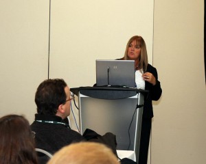
Crime Reduction and Crime Mapping – Sheila Serfas – RCMP
The second presentation I attended was on the use of GIS in public safety, by Sheila Serfas from the RCMP office in Halifax. During the presentation, Ms. Serfas showcased how she uses ArcGIS to target the offender versus the offence, identify and monitor crime hotspots, and the movement of crime throughout the Halifax District. Through utilizing their record management system and Esri’s mapping solution software, the organization is effectively reducing the amount of crime in the area through comprehensive mapping strategies. By mapping incidents of crime in a spatial context, she is able to redirect the officer’s focus to more proactive approaches, identifying areas with elevated crime rates, and taking steps to alleviate crime through increased monitoring, public interaction, and education.
After viewing Ms. Serfas presentation, I gained a greater appreciation for how GIS and mapping can improve public safety by effectively refocusing efforts, and mitigating crime rates.
Concluding Statements
With the end of the conference drawing near, there was time left for closing remarks, door prizes and networking. Although I did not win any of the prizes that were given away, I appreciated Esri’s enthusiasm in creating an event that was extremely enjoyable, not as an event that you had to go to, rather one that you enjoyed being at.
By the end of the conference, I had made many new connections, learned about many initiatives that I would otherwise not have known about, ate some great food, and enjoyed the company of people who share my love for geography and GIS.
The only facet I felt could have been improved upon would have been allowing more presentations and seminars that do not have such a heavily reliance on Esri software. As the conference was created and organized by Esri, I understand why this was the case.
In closing, I highly recommend the Esri User Conference for anyone in the GIS field that has a continued interest in the use of GIS, how the field is evolving, and the many GIS based solutions that are taking place across Canada.


Be the first to comment