GeoIgnite is Canada’s national geospatial conference hosted by GoGeomatics Canada.
GeoIgnite was held online via Zoom from July 22nd to 24th, 2020. This free event showcased the Canadian geospatial community and the leaders of Canada’s location technology sector. The conference brought together professionals from government and industry for innovative programming and updates on our sector. Every year, GeoIgnite is a unique opportunity for the geospatial community in Canada and abroad to learn, share, and engage with one another.
Session: Maxar- Monitoring Arctic Expansion and the Impact of Climate Change with High-Resolution Imagery
Speaker 1: Jake Dickinson– Production Manager, Maxar
If you missed out on this session during GeoIgnite 2020, this is an excellent opportunity to watch. Jake is the production manager of Maxar, and he talked about Maxar, the importance of using high-resolution satellites, and the three main themes.
He began the presentation by providing a brief history of Maxar and its products and services. Maxar is a space technology company with two divisions (Space division and earth intelligence division) and 60 years of industry leadership with over 90 satellites on-orbit today. Did you know that Maxar has over 20 plus year archive of very high-resolution imagery worldwide? Jack sheds light on the latest class constellation named Legion, which will be launched in 2021.
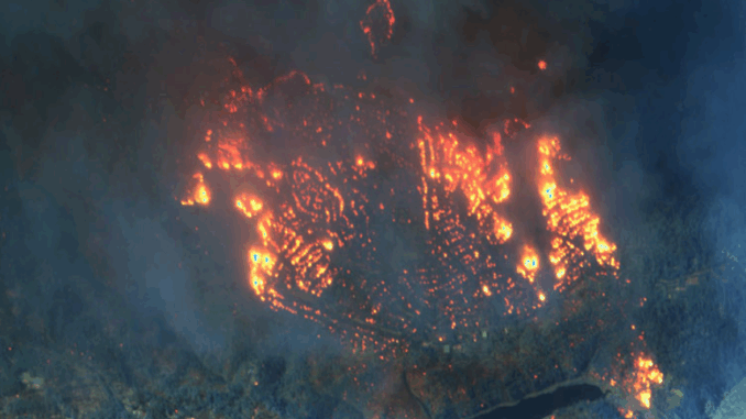
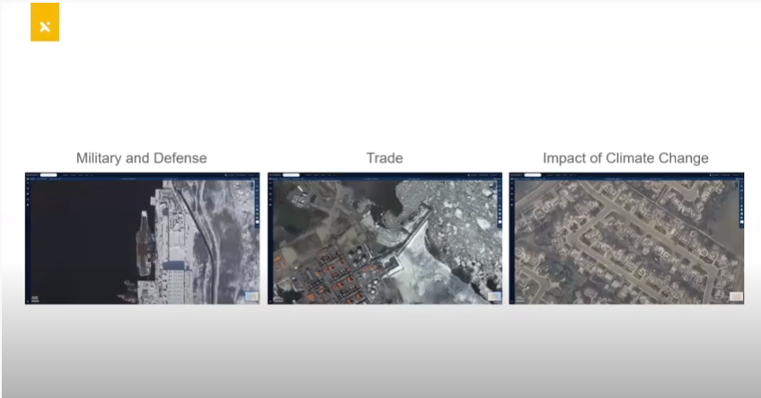
He further gave different examples of the current imaging satellite on the orbit with other areas related to Arctic expansion and climate change. The image below shows the three main themes he talked about. This includes military and defense, trade and impact, and climate change on people and the environment.

It is interesting to know how these three theme uses different cases and the importance of monitoring the earth where the other means are not readily available due to extreme conditions, national security regions, etc. One worth mentioning is the mechanism put in place from different countries to improve and monitor the arctic. Jake said, “as the arctic warms, nations have a new strategic focus on the region, the warming has and will continue to open up waterways to shipping and oil and gas exploration, and they are making the arctic a strategic economic region Canada’s architect and northern policy framework has a key goal of ensuring the Canadian arctic and north and its people are safe secure and well-defended outlining enhanced presence and responsibility of Canadian armed forces as well as other agencies.”
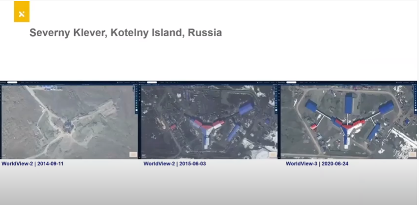
The importance of satellite imagery and resolution. Comparison of different arctic airbase with images taken some years ago and the current resolutions taken by improved satellites. Examples include Kotelny Island in Russia, Nagurskoye in Alexandria, Russia, Admiral Kuznetsov, Murmansk, Russia, etc. The picture below shows one of the arctic airbase and how it has changed over time.

To know more about different satellite imagery, do watch the video below or click here and enjoy the presentation.


Be the first to comment