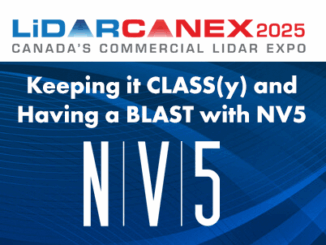
imagery
Geomatics Tools In The Protection and Conservation of North American Right Whales
Right Whale Biology + Conservation When speaking about declining populations in species, the words endangered, vulnerable and threatened often come…
MDA Announces Radarsat-2 Continuity Mission
February 2, 2021 MDA is excited to announce that the company has embarked on a major new initiative to build…
GeoIgnite 2020 Video: Maxar- Monitoring Arctic Expansion and the Impact of Climate Change with High-Resolution Imager
GeoIgnite is Canada’s national geospatial conference hosted by GoGeomatics Canada. GeoIgnite was held online via Zoom from July 22nd to…
GeoIgnite 2020: Growing Canada’s Next Earth Observation (EO) Generation
GeoIgnite is Canada’s National Geospatial conference hosted by GoGeomatics Canada. GeoIgnite was held online using Zoom July 22nd to 24th,…
Elexicon Energy and Quantum Spatial Canada Pilot Comprehensive Mobile Mapping Project
Elexicon Energy (Elexicon) was formed in April 2019 by the merger of Veridian Connections and Whitby Hydro Electric Corporation. Owned…
Quantum Spatial Canada Supports Disaster Preparedness on Vancouver Island Through Lidar Survey Covering 9000 Square Kilometers
Located off the Pacific Coast of British Columbia, Vancouver Island is home to just under 900,000 people, as well as…
Post-Wildfire Landscape Metrics & Transition Characteristics in Cariboo Regional District, 2017
The summer of 2017 marked one of the worst fire seasons in British Columbia’s history. By October, wildfires had covered…
Low-cost, less-time, lesser-logistics and high-accuracy mapping with drone-imagery
Highlights There is a tendency to use aerial photographs and digital images as the cartographic product!These pictures are the primary…
CubeWerx geospatial imagery platform goes production for the Canadian Government after a successful Build in Canada Innovation Program (BCIP) pilot
Gatineau, May 9, 2019 – CubeWerx today announced the successful transition of a Build in Canada Innovation Program (BCIP) pilot…
Your Global Geospatial Briefing for April 8th: 5G; 3D at Depth; Geospatial Intelligence Centre; Vulcan subscribes to Maxar; Smart Cities, Smart Infrastructure
AT&T prepares for 5G 5G is part of an oncoming data storm. 5G will be connected to autonomous cars, robotic…
Tarin’s Kim Koons discusses future of the geospatial data business in Canada
A GIS is not much use without the data. GoGeomatics turns our attention to Tarin Resource Services in order to…
Earth Observation: find, store, analyze and process GIS data within a single EOS platform
Most image analysis tasks can now run online thanks to EOS Platform, a new cloud service by EOS Data Analytics…