
- Mapping Indigenous Knowledge to Protect Congo Basin Diversity
- Singapore taps Lidar and laser scanning in remote building inspections
- Satellites reveal how deadly Morocco earthquake moved ground
- Putting Poverty Back on the Map: Introducing the World Bank’s New Geospatial Poverty Portal
- What is geospatial intelligence? A geographer explains the powerful melding of maps and data
- St. Louis AgTech firm uses geospatial technology to help farmers respond to changing climate
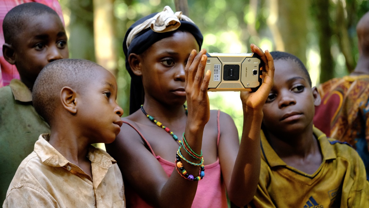
Mapping Indigenous Knowledge to Protect Congo Basin Diversity
The Baka people in the Congo Basin possess a profound understanding of their forest ecosystem, viewing nature as an intricate network where species influence each other and weather impacts all. This Indigenous knowledge has become invaluable for sustainability efforts in Central Africa and beyond. Collaborating with Baka experts, Thomas Smith, a Professor of Ecology and Evolutionary Biology at UCLA, founded the Congo Basin Institute (CBI) to advance conservation through their insights. Using geographic information system (GIS) technology, Baka guides contribute field notes about plant and wildlife locations, seasonal cycles, and interactions, which, when combined with data from various sources, create data-driven maps crucial for preserving the forest amidst shifting weather patterns and species distributions. This approach emphasizes preserving the processes that generate and maintain biodiversity, making it a promising model for conservation efforts in the Congo Basin and other biodiversity-rich regions.
Read the complete article here.
Singapore taps Lidar and laser scanning in remote building inspections
Singapore’s JTC and the Building and Construction Authority (BCA) have successfully trialed reality capture technologies like laser and Lidar scanning for Temporary Occupation Permit (TOP) inspections in two industrial developments. Using point cloud data generated by these technologies, detailed inspections can be conducted remotely, eliminating the need for physical inspectors on-site. These innovative methods were employed in virtual TOP inspections at JTC Logistics Hub @ Gul and the JTC semiconSpace project, enabling virtual site walkthroughs. These successful trials have prompted the development of virtual TOP guidelines for JTC projects, paving the way for broader industry adoption. Additionally, JTC is utilizing reality capture technologies for construction site management, achieving significant productivity gains and improved oversight of construction sites. They are also exploring applications in facilities management and preliminary work surveys.
Read the complete article here.

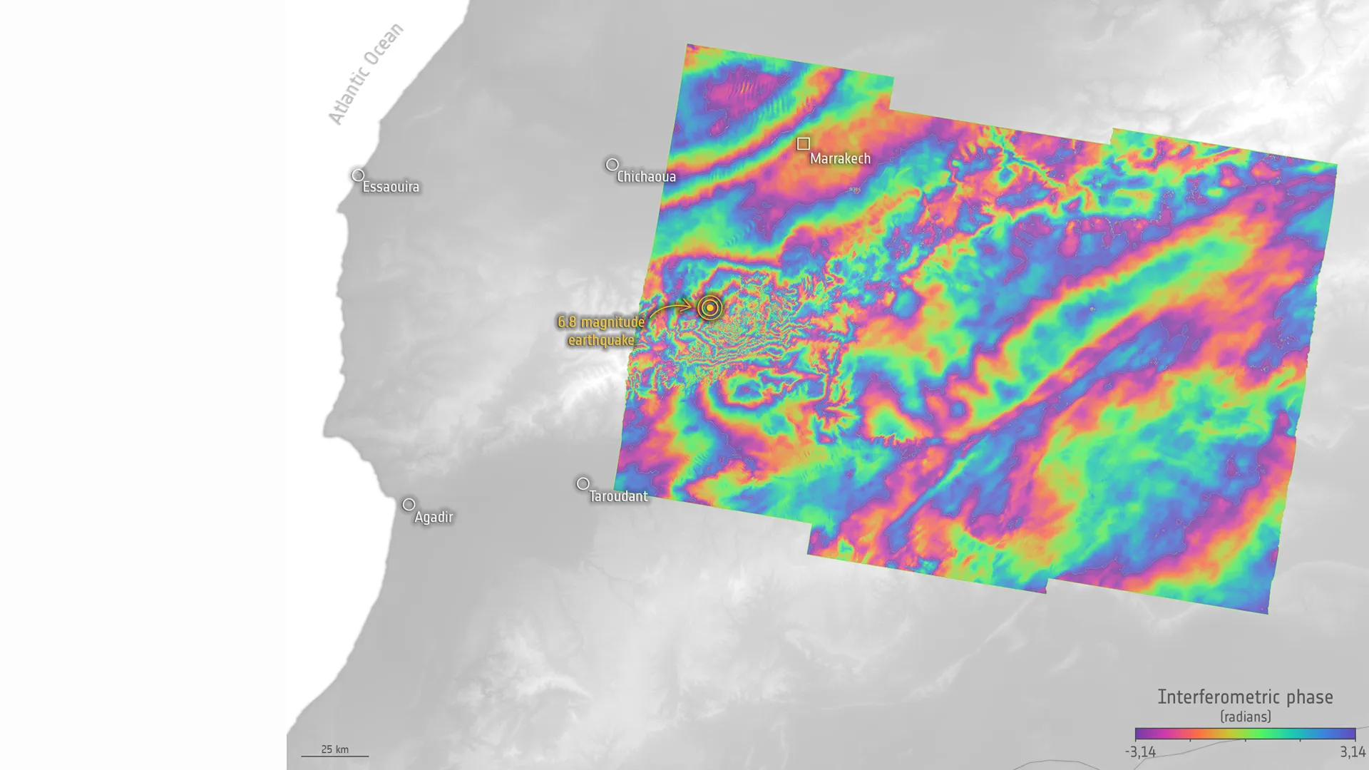
Satellites reveal how deadly Morocco earthquake moved ground
Satellite measurements have revealed that the 6.8-magnitude earthquake that struck western Morocco last week caused significant ground movement, shifting the Earth’s surface by up to 6 inches. The earthquake, which occurred in a rural region of the Atlas Mountains, lies on the boundary between the European and African tectonic plates, making it prone to seismic activity. Radar measurements from Europe’s Sentinel-1 satellites showed that the surface uplifted by a maximum of 6 inches in some areas while sinking by up to 4 inches in others. The earthquake resulted in the destruction of entire villages and claimed nearly 3,000 lives. The satellite images are aiding scientists and rescue teams in assessing the situation and the risk of subsequent tremors, providing crucial data for recovery efforts.
Read the complete article here.
Putting Poverty Back on the Map: Introducing the World Bank’s New Geospatial Poverty Portal
The World Bank has launched the Geospatial Poverty Portal, a crucial tool for understanding and addressing economic disparities at a subnational level worldwide. This portal offers detailed subnational poverty, inequality, and multi-dimensional poverty indicators across 1,600 subnational areas in 141 economies, utilizing data from the Subnational Poverty and Inequality Database (SPID). It highlights substantial variations in prosperity within countries, particularly in regions with stark rural-urban divides. For instance, Bangkok in Thailand has a poverty rate of nearly 0 percent, while the poorest province, Mae Hong Son, has a 47.3 percent poverty rate. The Global Subnational Atlas of Poverty (GSAP) maps subnational poverty rates, revealing that 182 subregions from 26 countries have poverty rates exceeding 50 percent. This tool also aids in assessing the vulnerability of the poor to climate risks, with 1.8 billion people exposed to one-in-100 year floods, and 780 million living below the World Bank’s Upper-Middle Income country poverty line, highlighting the intersection of poverty and climate risk. Small area estimation techniques are employed to provide granular data for analysis, offering a comprehensive resource for understanding and addressing poverty disparities at a local level.
Read the complete article here.

What is geospatial intelligence? A geographer explains the powerful melding of maps and data
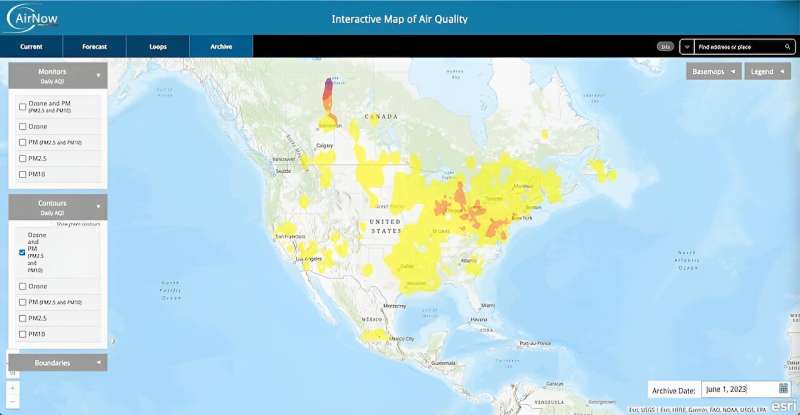
The summer of 2023 has brought a barrage of extreme weather events and disasters across the United States, including soaring temperatures, Canadian wildfires’ smoke, historic flooding, and a powerful hurricane. Despite these challenges, geospatial intelligence has proven invaluable in helping governments and organizations safeguard communities. Geospatial intelligence combines data from satellites, sensors, and aerial images to create real-time maps and simulations, aiding in identifying and responding to emerging threats. It has long been a crucial tool for emergency preparedness, response, and recovery, such as monitoring hurricane trajectories and assessing earthquake damage. Furthermore, it aids in environmental monitoring, military intelligence, logistics, transportation, and the development of digital twins. With the growing impacts of climate change and urbanization, the demand for geospatial intelligence is on the rise, and the industry is projected to expand significantly in the coming years, playing a pivotal role in ensuring safety, stability, and informed decision-making for the future.
Read the complete article here.
St. Louis AgTech firm uses geospatial technology to help farmers respond to changing climate
The geospatial sector in St. Louis is playing a crucial role in expediting the development of seed and crop products for farmers, particularly in light of shifting weather and climate patterns. Agriculture’s unique geospatial nature, with varying weather, soils, and ecosystems, demands precise information. Companies like Eiwa in St. Louis are at the forefront of leveraging technology to integrate data from multiple sources, with a focus on geospatial organization. They employ drone and satellite imagery, weather and soil data, and on-field notes to gain insights into factors like plant count, coverage, maturity dates, and more. This data-driven approach enables agribusinesses to make faster decisions, adapt to changing climates, and bring improved seeds and products to farmers in a shorter timeframe, ultimately enhancing agricultural resilience and productivity.
Read the complete article here.


Be the first to comment