• facebook
  • Twitter
  • Linkedin
  • Youtube
  • Linkedin Group
  • Post a Job
  • Post an Ad
  • Post an Event
  • Post a Directory Listing
  • Post a Press Release
  • Media Kit
  • My Account
  • Shopping Cart
  • Login
GoGeomatics
  • MAGAZINE
    • BIM & GIS
    • Community
    • Conference news
    • Earth Observation
    • Education & Careers
    • GEOAI
    • Announcements
    • Reality Capture & Lidar
    • Science
    • Technology
    • Between the Poles
  • Directories
    • ASSOCIATION
    • INDUSTRY
    • EDUCATION
    • Open Data
  • EVENTS
    • GeoIgnite Events
    • Events Calendar
    • GoGeomatics Meetups
  • Services
    • Advertising
    • Marketing
    • Post a Job
    • Post an Ad
    • Post an Event
    • Post a Press Release
    • Post a Directory Listing
    • Media Kit
    • Web Design
  • Find a Job
  • Volunteer
    • Start a GoGeomatics Group
    • Editors & Writers Group
  • About Us
    • About Us
    • Contact Us
    • Frequently Asked Questions
  • Videos
HomeTechnology

Technology

|||||
Community

A Student Perspective: CloudUAV & the Montreal 2017 Earth Observation Summit

29 June 2017 Jennifer Ridge | 2017

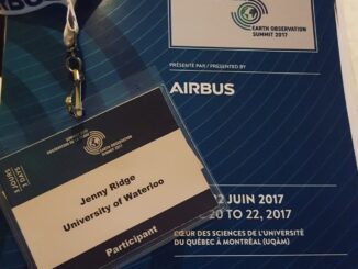
Last week, I attended the Earth Observation (EO) Summit in Montreal. It was a gathering of over 600 people from 22 countries with backgrounds ranging from researchers and students, to commercial industry and government representatives […]

Elevation Differences|GLM Topo
Technology

Grand Lake Meadows New Brunswick: Accuracy Comparison of Elevation Datasets

26 June 2017 Heather McGrath | DEM

Grand Lake Meadows (GLM), the largest wetland in New Brunswick. GLM is a historically and ecologically significant area which is ecologically diverse and home to an abundance of wildlife, due in part to the extensive […]

||||||||||
Education & Careers

Cartography & Art: Historic and Ancient Maps

25 June 2017 Manminder 'Meena' Kaur | ancient cartography

As much a science as an art; cartography makes one wonder how the artist or mathematician-cum-geographer captured the most finite of cartographic details. Ancient maps are fascinating and inspiring. In this article I will discuss […]

Two way arrows||Flowmapper default arrow style||Buffers at ends of arrows||Arrows themed by magnitude of flow|Polygon centroids tool|Provinces|Flow type Two Way||Flowmapper with flow type NET
Technology

Mapping Migration Flows with QGIS FlowMapper Plugin

23 June 2017 GIS Program Langara CS | Canada

Flow mapping is a technique to visualize movement of objects of interest between geographic areas. Typical uses of flow maps could be traffic volume, trade balances, or migration. In this article we create flow maps […]

|
Community

GeoPackage: A format with database capabilities

1 June 2017 Emmanuel Stefanakis | GeoPackage

A couple of months ago the Open Geospatial Consortium (OGC) sought public comment [1] on the new version of GeoPackage Encoding Standard [2]. GeoPackage is an emerging format for geospatial data. Officially introduced three years […]

|||
Community

May 16: Thunder Bay GoGeomatics Speaker: Rob Rempel – Research Scientist MNRF

2 May 2017 GoGeomatics Canada | 2017

You are cordially invited to our fun free event geomatics networking event on May 16th.  Tuesday, May 16, 2017 – 5:00 PM The Foundry 242 Red River Rd, Thunder Bay, ON Please RSVP by Joining […]

|||
Technology

Mystery Speaker Revealed for Next Ottawa GoGeomatics Social April 25th

20 April 2017 Jon Murphy | 2017

GoGeomatics has swept aside the curtain to reveal Masroor Hussain, Senior Scientist and Software Developer at PCI Geomatics, as the mystery guest speaker for the April 25th GoGeomatics social in Ottawa. For weeks we at […]

|||||
Technology

Google Earth Engine – What is a Data Cube and Why Canadians Should Care

19 April 2017 Sabina Zaidi | 2012

What is a data cube and how is it used for big data analytics?  How does a data cube work with remotely sensed data? Before writing this article I had never heard of a data […]

Posts pagination

« 1 … 123 124 125 … 146 »

Events

Notice
There are no upcoming events.

View All Events

Services

  • Post a Job
  • Post an Ad
  • Post an Event
  • Post a Directory Listing
  • Post a Press Release
  • Media Kit
  • My Account
  • Shopping Cart
  • Login

Jobs

Post a Job
  • GIS Technician
    Sudbury, Ontario
  • Asset/GIS Coordinator
    Edson, AB
  • Civic Operations GIS Technologist (Permanent, Full-Time) – 1953
    Kamloops, British Columbia
  • Senior Manager, Data Science – Geospatial
    Mississauga, Ontario
View All Jobs
  • Directories
    • Associations Directory
    • Industry Directory
    • Education Programs
    • Open Data
  • Volunteer
    • Start a GoGeomatics Group
    • Editors & Writers Group
  • About Us
    • GoGeomatics Media Kit
    • Who We Are
    • Contact Us
    • FAQ’s
    • Advertising
    • Marketing
  • Subscribe
GoGeomatics
GoGeomatics is the largest and most popular communications hub promoting the Canadian geospatial community. The business was incorporated in 2011. GoGeomatics hosts over 100 fun, free, location technology networking events each year in cities across Canada.

© 2026 GoGeomatics

  • facebook
  • Twitter
  • Linkedin
  • Youtube
  • Linkedin Group