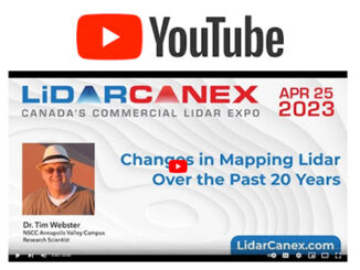
• facebook
  • Twitter
  • Linkedin
  • Youtube
  • Linkedin Group
  • Post a Job
  • Post an Ad
  • Post an Event
  • Post a Directory Listing
  • Post a Press Release
  • Media Kit
  • My Account
  • Login
GoGeomatics
  • MAGAZINE
    • BIM & GIS
    • Community
    • Conference news
    • Earth Observation
    • Education & Careers
    • GEOAI
    • Announcements
    • Reality Capture & Lidar
    • Science
    • Technology
  • Directories
    • ASSOCIATION
    • INDUSTRY
    • EDUCATION
    • Open Data
  • EVENTS
    • GeoIgnite Events
    • Events Calendar
    • GoGeomatics Meetups
  • Services
    • Advertising
    • Marketing
    • Post a Job
    • Post an Ad
    • Post an Event
    • Post a Press Release
    • Post a Directory Listing
    • Media Kit
    • Web Design
  • Find a Job
  • Volunteer
    • Start a GoGeomatics Group
    • Editors & Writers Group
  • About Us
    • About Us
    • Contact Us
    • Frequently Asked Questions
  • Videos
HomeTechnology

Technology

|
Technology

Carrying on the Legacy: SUMSF 2023 Call for Sponsors, Speakers, Workshops

11 March 2023 GoGeomatics Canada | announcement

Call for sponsors, speakers, and workshops! The Subsurface Utility Mapping Strategy Forum (SUMSF) 2023 is coming to you May 16-18, 2023.  This online event has free registration, so don’t miss out on workshops, keynote speakers, and […]

|
Technology

Transport Canada shares Facts About Canadian Drones and RPAS Certification in 2023

8 March 2023 GoGeomatics Canada | Archaeology GIS

In February 2023, Transport Canada released a newsletter on Remotely Piloted Aircraft Systems (RPAS), which included interesting statics on the number of registered drones and issued pilots certificates. As there is an increase in the […]

|||||||
Technology

Canadian Geospatial Digest March 6th, 2023

6 March 2023 Volunteer Editors and Group Writers | Arctic

Introducing BC’s Big Tree Project Map GeoTech Training by GoGeomatics Value of Geospatial Data for Government Whale Safety and ship traffic management Geoscience BC refines model of Kootenay Lake geothermal project Canada’s Sapphire Satellite 10-year […]

|||||
Technology

In the Red: Thermal Imagery Helps Reveal Building Heat Loss

2 March 2023 Mary Jo Wagner | Archaeology GIS

Dr. Geoffrey Hay envisioned a solution for an invisible problem in a few milliseconds. Hay, a GIScience professor at the University of Calgary in Alberta, Canada, was perplexed by his higher than expected heat bills […]

||||||
Technology

International Geospatial Digest February 27th, 2023

27 February 2023 Volunteer Editors and Group Writers | aerial mapping

1. TuneIn Explorer: How To Discover Local Radio Stations On A World Map 2. Satellite data reveals long-term drought conditions in Europe 3. Geospatial Imagery Analytics Market size 2023-2033 4. Maxar Secures Dedicated Access to […]

||||||||||||
Technology

Geo Week 2023 – Cool Stuff!

23 February 2023 Gavin Schrock | aerial mapping

The Geo Week exhibition and conference, held in Denver Colorado, February 13-15, attracted 3,000 attendees from over 50 countries. And over 175 exhibitors. Here’s a few highlights from the geo-coolness in the exhibit hall and […]

|
Technology

Navigating Uncertainty in the Digitization of AEC

21 February 2023 Gavin Schrock | AEC

What are strategies for digitizing your AEC enterprise during peak times, and slow times? A conversation with Claire Rutkowski, senior VP and CIO for Bentley Systems We’ve been talking to various AEC firms, large and […]

|||||
Technology

Canadian Geospatial Digest February 20th, 2023

20 February 2023 Volunteer Editors and Group Writers | Acosys consulting

City of Guelph chosen Canadian city to lead development of next-generation emergency services database First Nations say traditional knowledge should help shape federal flood maps Sea urchins on the move How Ecopia AI’s Maps Are […]

Posts pagination

« 1 … 53 54 55 … 141 »

Events

Notice
There are no upcoming events.

View All Events

Services

  • Post a Job
  • Post an Ad
  • Post an Event
  • Post a Directory Listing
  • Post a Press Release
  • Media Kit
  • My Account
  • Login

Jobs

Post a Job
  • Canada Maps and Poster Gallery Volunteer Leads — GeoIgnite 2026
    remote
  • Software Engineer – Geographic Information System (GIS)
    Ottawa, ON
  • GIS Data Quality Analyst
    Burnaby, British Columbia
  • GIS Cartographer
    Montreal, QC
View All Jobs
  • Directories
    • Associations Directory
    • Industry Directory
    • Education Programs
    • Open Data
  • Volunteer
    • Start a GoGeomatics Group
    • Editors & Writers Group
  • About Us
    • GoGeomatics Media Kit
    • Who We Are
    • Contact Us
    • FAQ’s
    • Advertising
    • Marketing
  • Subscribe
GoGeomatics
GoGeomatics is the largest and most popular communications hub promoting the Canadian geospatial community. The business was incorporated in 2011. GoGeomatics hosts over 100 fun, free, location technology networking events each year in cities across Canada.

© 2025 GoGeomatics

  • facebook
  • Twitter
  • Linkedin
  • Youtube
  • Linkedin Group