Technology
NV5 Geospatial Helps Okanagan Basin Water Board Protect Important Local Communities Through Near-Shore Topobathymetric Lidar Survey
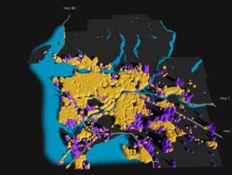
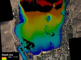
The Okanagan Valley in British Columbia is one of Western Canada’s most attractive tourist destinations, with local communities offering a range of active and relaxing activities organized around the region’s many lakes and rivers. The […]