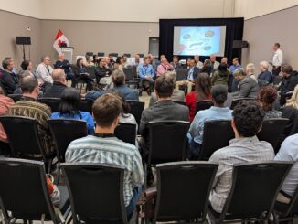
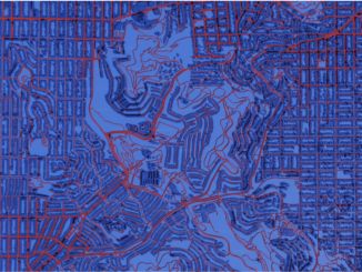
• facebook
  • Twitter
  • Linkedin
  • Youtube
  • Linkedin Group
  • Post a Job
  • Post an Ad
  • Post an Event
  • Post a Directory Listing
  • Post a Press Release
  • Media Kit
  • My Account
  • Shopping Cart
  • Login
GoGeomatics
  • MAGAZINE
    • BIM & GIS
    • Community
    • Conference news
    • Earth Observation
    • Education & Careers
    • GEOAI
    • Announcements
    • Reality Capture & Lidar
    • Science
    • Technology
    • Between the Poles
  • Directories
    • ASSOCIATION
    • INDUSTRY
    • EDUCATION
    • Open Data
  • EVENTS
    • GeoIgnite Events
    • Events Calendar
    • GoGeomatics Meetups
  • Services
    • Advertising
    • Marketing
    • Post a Job
    • Post an Ad
    • Post an Event
    • Post a Press Release
    • Post a Directory Listing
    • Media Kit
    • Web Design
  • Find a Job
  • Volunteer
    • Start a GoGeomatics Group
    • Editors & Writers Group
  • About Us
    • About Us
    • Contact Us
    • Frequently Asked Questions
  • Videos

Magazine

Earth Observation

Across Canada, Provinces Step Up for Wildfire Season

21 April 2026 Alefiya Dungrawala | British Columbia

As climate patterns shift, Canada’s wildfire season is growing longer and more severe. After devastating seasons in 2023, 2024, and 2025, provinces are ramping up preparedness efforts. With ongoing drought in northwestern regions and a […]

BIM & GIS

Canadian Geospatial Digest – April 20th, 2026

20 April 2026 Volunteer Editors and Group Writers | ADP

Teaching drones to think: UVic’s AI-powered aerial mapping system ‘Avoid the honk’: Interactive map helps Waterloo students stay away from Canada geese 33 glacial lakes hidden under the Canadian Arctic mapped Saab dangles sovereign data […]

Magazine

K2 Geospatial Joins GeoIgnite 2026 as Silver Partner to Advance Digital Sovereignty in Canada’s Geospatial Ecosystem

15 April 2026 GoGeomatics Newsmakers | Canadian Geospatial

K2 Geospatial Joins GeoIgnite 2026 as Silver Partner to Advance Digital Sovereignty in Canada’s Geospatial Ecosystem Montreal, Canada, April 2026 K2 Geospatial, a Canadian leader in geospatial technology and geographic information systems (GIS), has announced […]

Community

Mapping Our Future: The OGC Canada Forum Is Building a Better-Connected North

15 April 2026 OGC Canada Forum | BIM-GIS integration

Canada is one of the most complex geospatial environments in the world—spanning provinces, territories, Indigenous lands, and sectors that don’t always connect easily. It also covers vast and varied terrain, from coastlines and inland waters […]

Magazine

International Geospatial Digest for April 14th, 2026

14 April 2026 Volunteer Editors and Group Writers | Avenza

Industrial logging expansion and the end of roadless protection The data bottleneck for physical AI Open source satellite damage mapping in conflict zones Blue Marble and Avenza connect field and office workflows Mapping and naming […]

Magazine

How Canada Can Build a Trusted Ecosystem for Ethical AI

13 April 2026 Alefiya Dungrawala | Agentic GIS

Geoffrey Hinton: “If we don’t have AI regulations, we’re going to be in terrible trouble.” Toronto-based Nobel laureate Geoffrey Hinton, widely regarded as the godfather of artificial intelligence, clearly stated this at the CIC National […]

GeoIgnite 2026 Ottawa conference speaker Canada flag
Community

How to Attend GeoIgnite 2026: Tickets, Pricing, and What You Actually Need

12 April 2026 GoGeomatics Canada | Canada geospatial industry

GeoIgnite 2026 takes place in Ottawa from Monday, May 11 to Wednesday, May 13, 2026. This guide explains GeoIgnite 2026 tickets, pricing, and how to choose the right way to participate. For a broader overview […]

Community

GeoIgnite 2026: Where Canada’s Geospatial Leadership Comes Together

12 April 2026 Jon Murphy | Arctic geospatial

Some years, conferences come and go as part of the regular cycle. Other times, the broader context makes them more important. 2026 is shaping up to be one of those years. Across Canada, there is […]

Posts pagination

« 1 2 3 … 698 »

Events

May 27
May 27 @ 8:00 am - May 29 @ 5:00 pm

Canadian Cartographic Association Conference 2026

May 27
May 27 @ 8:00 am - May 29 @ 5:00 pm

CCA 2026 Conference: Coast to Coast to Coast

Jun 1
June 1 - June 4

CAG/CARTO Annual Meeting 2026

Jul 4
July 4 @ 8:00 am - July 11 @ 5:00 pm

ISPRS Congress 2026

Sep 15
September 15 - September 17

INTERGEO 2026

View Calendar

View All Events

Services

  • Post a Job
  • Post an Ad
  • Post an Event
  • Post a Directory Listing
  • Post a Press Release
  • Media Kit
  • My Account
  • Shopping Cart
  • Login

Jobs

Post a Job
  • Cartographic Analytical Technician / Technicien, analyses cartographiques; technicienne, analyses cartographiques
    Peterborough
  • Survey Technicians (Field and Office)
    Calgary, Alberta
  • Volunteer Editorial Contributor – Be Part of Canada’s Geomatics Story
    Remote
  • GIS Technician
    Nelson, BC
View All Jobs
  • Directories
    • Associations Directory
    • Industry Directory
    • Education Programs
    • Open Data
  • Volunteer
    • Start a GoGeomatics Group
    • Editors & Writers Group
  • About Us
    • GoGeomatics Media Kit
    • Who We Are
    • Contact Us
    • FAQ’s
    • Advertising
    • Marketing
  • Subscribe
GoGeomatics
GoGeomatics is the largest and most popular communications hub promoting the Canadian geospatial community. The business was incorporated in 2011. GoGeomatics hosts over 100 fun, free, location technology networking events each year in cities across Canada.

© 2026 GoGeomatics

  • facebook
  • Twitter
  • Linkedin
  • Youtube
  • Linkedin Group