
GoGeomatics Canada had the privilege of interviewing one of their very own editors, Melanie Tranter!
GoGeomatics: We would like to begin by welcoming Melanie Tranter to the GoGeomatics Canada community. Melanie, can you start off the interview by telling us a little bit about yourself?

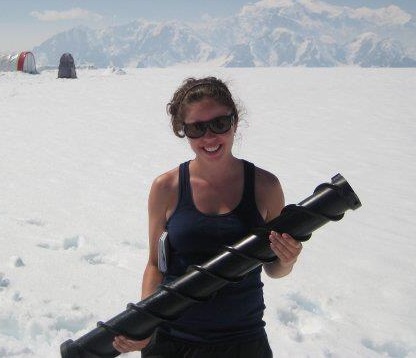
Melanie: Where do I start?! I am an Ottawa native and I attended Ottawa U completing an Honours BA in Geography, Geomatics and Spatial Analysis in 2006. I was one of the first graduates of the concentration program in Geomatics and Spatial Analysis at Ottawa U. At the time, GIS was at the fore front of technology and I thought since I’ve always loved navigating using maps, it might be a good avenue to pursue. After starting the program at Ottawa U, I never thought I would have spent THAT much time in the GIS lab. I’m sure every geomatics student can attest to those long hours! I’ve worked and travelled in almost every province and territory in Canada. I’ve spent over 2 years in Asia traveling and teaching english and currently I’m working for NAV Canada in Ottawa as a land use specialist. I have been lucky to work in the geomatics field securing contracts since graduation. In my spare time I’m either helping out with the GoGeomatics site, downhill skiing or walking my Boston Terrier, Rocky.
GoGeomatics: How did you first hear about the GIS/Geomatics world and what drew you to it?
Melanie: In University, I was not sure of what direction I wanted to go and what courses to take to lead me to a career path. I needed something technical that could help me land a professional career. Ottawa U started a concentration in Geomatics and Spatial Analysis and I signed up hoping to boost my degree with more concrete practical skills. This proved to be an invaluable choice that has helped propel my career into a fascinating domain. The geomatics positions are becoming more interdisciplinary and I’m enjoying the challenges.
GoGeomatics: Can you provide us with more information on your first GIS/Geomatics job and what made you the successful candidate?
Melanie: My first GIS job was a contract as a Junior Geographer with Elections Canada. I completed my undergrad while working full time on contract as an Administrative Assistant with the department of Fisheries and Oceans. Once my contract was up, I applied to work through an agency in Ottawa called Prologic Systems for the position of Junior Geographer. They had secured a contract with Elections Canada for about 8 months. Since I speak french, had some prior federal government experience and a university degree in geography and GIS, I think that is what made me a competitive candidate for the position. The project involved adjusting electoral voting boundaries in Canada based on the number of constituents in each region. I remember moving a lot of lines!
GoGeomatics: You used to work at Outland Resources Inc. for 7 years in Alberta, Canada. Can you tell us more about your roles with this company and what made you want to move Alberta, Canada?
Melanie: Outland Resources is mainly a tree planting and resources management company and was a seasonal job. In order to help pay for my education I planted trees for 5 summers in Ontario, Saskatchewan, Alberta and BC. After my fifth season, I moved up to middle management securing a position as a Crew Boss with 17 tree planters on my crew. This position gave me a crash course in project management, stakeholder consultation, leadership, time management and safety in the work place. I also learned how my geography and GIS skill set could help me in the field. I worked on some side projects including block layout – which included walking in the middle of no where Alberta with a GPS to map out the size and location of a cut block. The part I loved about working for Outland was being outdoors, working near the rockies with an incredible view and the feeling of having worked my butt off every day.
GoGeomatics: You are currently working for NAV Canada as a Land Use Specialist. Can you tell us a little bit about NAV Canada and how their services incorporate GIS/Geomatics applications on a day-to-day basis?
Melanie: Nav Canada http://www.navcanada.ca/ is the air navigation service provider in Canada. I work in the Aeronautical Information Services, Land Use unit of NAV, working to determine and coordinate with stakeholders if an obstacle, such as a communication tower, will impose any safety risk or impact a flight procedure in Canada. We use several GIS technologies, sush as Map Point and Touratech. We coordinate information and data between several sources, both public and private and are using GIS applications daily by analyzing the spatial impacts of obstacles. Every assessment coordination I compete is like writing a mini novel for our stakeholders to read and it is their job to write an short essay!
GoGeomatics: You started off at NAV Canada as an Aeronautical Information Services Assembly Specialist and then were promoted to a Land Use Specialist within a year. What responsibilities do you have now that differ from your previous position?
Melanie: In my previsous position at NAV, I was working on editing an aeronautical publication called CAP (Canadian Air Pilot). The CAP is a flight publication document that pilots use for take off and landing procedures. I mostly used my cartographic license to edit and produce the CAP charts. You can see a sample of what a page in the CAP looks like here: CAPDrydenRegional
GoGeomatics: You are currently in the process of completing an online certificate at Ryerson University. Can you provide us with more information on what you are specialising in and how this is going to help you?
Melanie: Since the GIS field is constantly evolving, I wanted to upgrade my skills and knowledge to reflect what is happening in the industry today. I recently completed a course called Issues and Innovations in Digital Geography and GIS. We learned about concepts including cloud sourcing, data sharing and the validity of data. I did a short paper on the development and use of LiDar which is a technology I am not very familiar with. The next course will look at Digital Geography Applications in Business Decison-Making in the industry. The knowledge gained from this certificate is applicable to my position with Nav Canada and a great way to keep current. I can complete the courses online, which means I can upgrade my skills while still remaining active in the work force.
GoGeomatics: Have there been any highlights throughout your university or professional career you would like to share with us?
Melanie: While working with Outland I was lucky to work on a contract where we flew to work everyday in a helicopter. I don’t think anything in Ottawa has come close to that yet…
GoGeomatics: Would you like to share anything else with us?
Melanie: It’s exciting to see the changes and development of GIS and geomatics in Canada. Having joined GoGeomatics less than a year ago, it has given me great insight into varying careers, meeting great individuals involved in the community as well and being a part of a growing profession. I’m excited to follow the growth of Canadian geomatics and be a part of this rapidly changing technology.
GoGeomatics: Do you have any plans for the future that concerns GIS/Geomatics?
Melanie: Absolutely! There are two goals I hope to achieve in the next few years. My interests lie in resource management and urban development. I want to complete a Master’s degree and persue a project management role within these domains. I am not sure how things will pan out exactly, but those are my main future goals with respect to GIS and Geomatics: to incorporate my academic interests and my profession in a project management role. I’ll be sure to keep you posted!


Be the first to comment