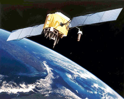
Lidar CANEX is Canada’s commercial lidar expo online. This is a free event for participants where they can see the latest services and technology on offer by some of the most exciting global companies. This year the event welcomes Calvin Klatt to discuss The GALILEO High Accuracy Service (HAS) and where Canada stands in relation to it.
GALILEO will provide free-of-charge high-accuracy PPP corrections. This could be a game-changer. For decades, Canada has been at the forefront of Precise Point Positioning (PPP) technology, and the Canadian Geodetic Survey CSRS-PPP service has worldwide popularity with usage exceeding one million files annually.
Dr. Calvin Klatt, Director and Chief Geodesist, of the Canadian Geodetic Survey at Natural Resources Canada explains, “PPP tools enable users to correct position information by approximately two orders of magnitude, typically meters to centimeters. The resulting position information meets government requirements for engineering and land surveying and is suitable for a wide range of scientific purposes. A kinematic mode is provided to support applications such as Lidar data collection.”
“Towards Real-Time,” a 2002 conference held by the International GNSS Service in Canada, began a global effort to develop real-time PPP-type solutions.
These efforts have heralded the arrival of free public-good PPP broadcast services. It is expected centimeter-level near-instantaneous positioning suitable for precise vehicle automation and similar applications will appear in a few years. Many applications will lead to economic impacts by demanding “low-cost, compact, commercial off-the-shelf receivers.”
When GPS first came out, it had gaps at the poles and in certain environments. When the PPP high-accuracy service arrives, the local ionospheric and atmospheric constraints will bring countless benefits. The EU is making substantial investments to support users and innovation so that the economic benefits are realized across their economy. An EU company is developing electrical smart grid equipment with the substantial advantage of better timing information from Galileo HAS, including integration support.
Nations such as the EU, US, UK, Australia, New Zealand, and China already have plans for the start of these advanced services or are quickly developing investment plans.
 As of today, the Government of Canada has yet to invest in the provision of real-time PPP data or constraints to improve the services. Suitable GNSS observing stations are sparse in Canada, so the provision of constraints will not be easy. The country’s industry will soon be at a significant disadvantage in economic sectors. Finance, Telecommunications, Instrument timing and synchronization, all modes of transportation, precision, robotic agriculture, and land surveying will be impacted, with Transportation most affected.
Klatt says, “As chief geodesist of Canada, I am concerned that there will be ‘have’ and ‘have-not’ nations in the future. The ‘have’ nations will develop products that rely on highly reliable and precise PNT services, while the ‘have-not’ nations will be in a technological ‘ghetto’ developing lower quality products for countries with similarly poor digital infrastructure.”
Studies have been done on the cost of GNSS failures in many countries. If there were such a failure in Canada, the cost could be about 1 billion CAD per day.
Klatt wonders, “There are trillions of dollars worth of innovation coming in the geospatial domain, driven in large part by new positioning technology. Will Canadians ride this wave?”
Join us for this important talk at Lidar CANEX on April 25th, 2023. Claim your free ticket to attend online here


Be the first to comment