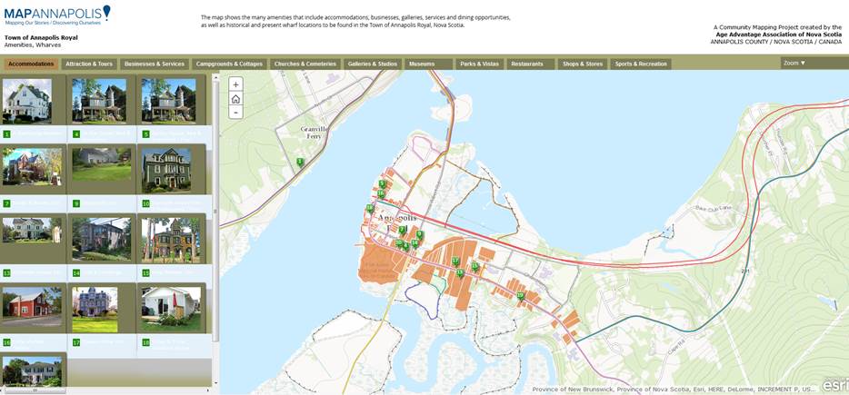
On April 7th, I attended the community mapping showcase at the NSCC Centre of Geographic Sciences (COGS). This project is a collaboration between the Age Advantage Association, a not-for-profit group of seniors in the Annapolis Valley and the instructors and students in the Diploma of Geographic Sciences, Community and Environmental Planning program. Key contacts are Heather Leblanc (AAA) and Ed Symons and Monica Lloyd (NSCC). The web-based maps are delivered in both ArcGIS Online and Google. Check out the web site at www.mapannapolis.ca . This inter-generational project allows seniors to bring their local knowledge of the landscape to the map, and COGS students to bring their GIS and cartographic expertise to the table.
Specific maps for the Annapolis Valley include:
– Historic homes/ cemeteries
– Wharves,churches,trails
– Black loyalist/ Acadian home sites
– Cultural assets
– Bear River artisans
 The most recent innovation is the creation of an online form which allows community members to propose and add additional features to the geographic database.
As part of the showcase, Trish LeBlanc from the COGS Map Library provided a tour of the Walter Morrison collection of historic maps. Here, cartography students can compare maps of the early settlements with their present representation. http://bit.ly/COGSmaps
Where to go from here ?
Currently, the community mapping project is hosted using the technology available at the college. It offers a rich and eclectic view of the 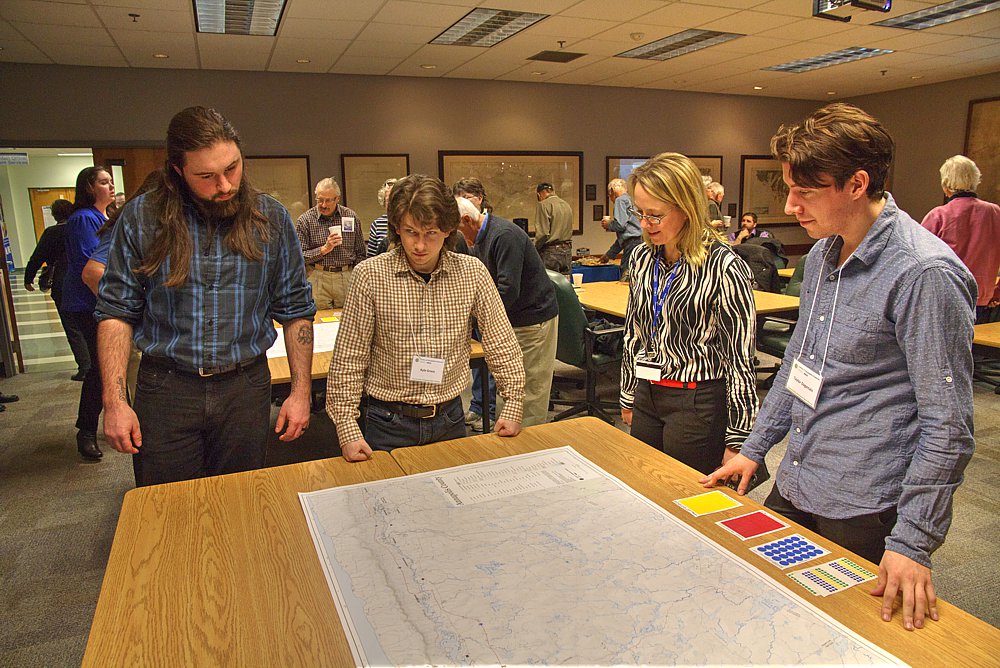 cultural landscape. Much of it based on a series of maps commissioned by Annapolis Ventures book, ‘ Cemeteries, Graveyards and Burying Grounds in Annapolis County’ n.d.. If these online community maps are to be used for Community Planning, then it will be important for the technology to remain current. To address these concerns, there will need to be agreements about ownership of the data, quality control and access for decision making purposes. The community mapping project is an excellent initiative which uses the skills and interests of the local residents, and links it with GIS technology at the college. To be sustainable, it likely requires its own portal, with appropriate access rights for the different ‘communities of interest’.
Modern web GIS facilitates this type of collaboration, where local connects with global. The Annapolis Valley has a wonderful resource at COGS, which can help address deeper conversations about the creative rural economic (Greg Baeker) and place-based education ( David Gruenewald and Gregory Smith).
There are a number of similar initiatives happening in other parts of rural Canada.
For example, Vancouver Island (www.whereishereculturalmapping.com).
In conclusion, in the words of Map Annapolis :
‘”Community- created asset maps are based on the premise that local residents possess expert knowledge of their local environment which can be expressed in a geographic framework which is easily understandable and universally recognized. Participatory maps often represent a socially or culturally distinct understanding of landscape and include information that is excluded from mainstream
Greg Baeker. Rediscovering the Wealth of Places: a municipal cultural planning handbook for Canadian communities. Published by Municipal World.
David A. Gruenewald and Gregory Smith (ed.) 2008. Place-based Education in the Global Age. Taylor and Francis.


Be the first to comment