cloud
Satellite-Based Earth Observation Market Analysis – Trends and Forecast
Satellite-based Earth Observation (EO) is a process of using remote-sensing technique to gather information on the chemical, physical and biological…
Blue Marble Announces Featured Speakers for 2014 User Conference in Calgary
Blue Marble Geographics (bluemarblegeo.com) is pleased to announce the featured speakers for the 2014 Blue Marble User Conference (BMUC) to…
Communications & Power Industries Canada Receives Contract for Earth Observation Mission
GEORGETOWN, Ontario – Communications & Power Industries Canada Inc. (CPI Canada) has been awarded a $3.3 million contract from the…
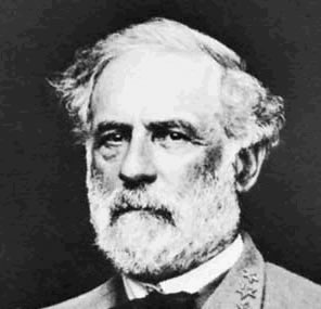
Gettysburg: What Could Lee See?
In an age devoid of modern communications methods and digital maps, military generals often made tactical decisions based on what…
OGC Academic Summit 2014 – Call for Presentations
The Open Geospatial Consortium (OGC) has issued a call for presentations and presentation abstracts at the inaugural OGC Academic Summit…
GeoDigital Secures Funding
HAMILTON, Ontario, June 11, 2014 – GeoDigital International Inc. (“GDI”), the leading provider of next‐generation 4D Geospatial imaging and business…
Port Metro Vancouver Implements Webtech Wireless’ GPS Solution
Webtech Wireless Inc.(TSX:WEW), a leading provider of vehicle fleet location-based services (LBS) and telematics technology, today announced that Port Metro Vancouver selected…
Esri Pledges $1B in Cloud-Based STEM Software to White House ConnectED Initiative
With Support from Amazon Web Services, Esri to Make Free ArcGIS Online Accounts Available to all Elementary and Secondary Schools…
BlackBridge Unveils Concept for its New Mission
Enhanced capabilities, including very high resolution and superspectral bands, will be the new benchmark for commercial earth observation Berlin, Germany…
BlackBridge Secures $22 Million for New Satellite Constellation
A new generation of RapidEye Satellites is underway Berlin, Germany – BlackBridge has secured $22 million (CDN) in funding from…
K2 Geospatial USA & BMSI offer U.S. municipalities integrated GIS-enabled work order management solution
K2 Geospatial USA and BMSI join forces to offer U.S. municipalities a cutting-edge integrated GIS-enabled work order management solution. Tom…
OpenTreeMap Launches in Edmonton
Azavea, a geospatial analysis (GIS) software development company, announces the launch of OpenTreeMap, its collaborative platform for crowdsourced tree inventory,…


