database

GIS Open Source versioning tool for a multi-user Distributed Environment (part 1)

Editors note: This article has been jointly written by Nicolas Gignac, Dami Sonoiki (eHealth Africa) and Samuel Aiyeoribe (eHealth Africa). These authors…

Eastern Canada

Grand Banks to the Gulf of Mexico: My Canadian Geomatics Career

I often contemplate what it would have been like working at the same job for an entire career. Mind you,…

The Integrated Cadastral Information (ICI) Society and ParcelMap BC

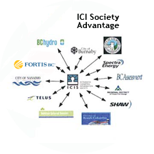
This is the first of two articles on the release of ParcelMap BC Data, which we see as a significant…

Upgrade your Geospatial Skills: leveraging the power of MOOCs

What I want to share with you are some resources related to something called Massive Open Online Course (MOOC) where…

Graph Databases – Recent development in Neo4j may help accommodate the Geospatial Community

Graph Databases and GIS & Technology (GIS&T) In the era of big data, graph databases are becoming very popular as…

Making is Connecting: the social meaning of creativity

I spent Christmas in Sydney, Cape Breton. While there, I had the time to read David Gauntlett’s book ‘Making is Connecting’.…

The Future of GIS Software? QGIS A Popular Open-Source GIS for the Masses

In today’s geomatics society, ArcGIS, developed by Esri, is a giant and dominates the GIS software market. However, there are…

Canadian Geomatics Innovation: Ecere Develops a Next Generation GIS

Not many companies undertake the ambitious goal of creating a new geospatial software suite from scratch. Ecere, a Canadian company…

Predicting the Future of the GIS in Canada

Editors note: This article has been jointly written by Bruce McCormack and Gordon Plunkett. Bios can be found at the…

Contrasting: GIS & Geomatics Education in Canada and China

I have studied Geographic Information Systems (GIS) in both Canada and China. Last summer I completed my master in geography at…

Geospatial Development: Enhancing GIS curricula with programming skills at UNB

Geospatial information science and technology (GIS&T) has rapidly evolved over the last few decades. This evolution has created a highly…

Easy Access to Data: The CGDI Initiative

The Canadian Geospatial Data Infrastructure (CGDI) is an initiative of Natural Resources Canada that began in 2001. The CGDI does…