download
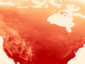
QGIS & WorldClim: Using Zonal Statistics to Map Temperature Patterns
There has never been a time in the history of GIS when so much free, high quality data has been…
Montreal: SimActive Offers Free Trial of UAV Software
Montreal, Canada, October 11th, 2016 – SimActive Inc., a world-leading developer of photogrammetry software, is pleased to announce a new…
DigitalGlobe’s Basemap Suite Expands: 250 Million Square Kilometers of 30 cm Imagery
DigitalGlobe, Inc. (NYSE: DGI), the global leader in Earth imagery and information about our changing planet, today announced that its…
CCMEO: GeoConnections Funding Geomatics Projects for 2016-2018
For this announcement, GeoConnections is focusing funding towards projects that address the following themes: -Innovative adoption and further development…
RouteMagic: A Unique Way of Mapping Your Bike Route
Always at the forefront, the CycleMap application is revolutionising how people plan their bike rides with its RouteMagic, a new…
How Pokémon Go can encourage a love of outdoors … and family …
In a prior piece, Jonathan Murphy pointed out that fun and geospatial awareness can go together through a game. I…
Toronto Police Launch Student Open Data for Change Competition
Chief Mark Saunders and Ryerson University Interim Provost and Vice President Academic Dr. Christopher Evans announced a Public Safety Open…
The Most Fun You’ve had with Geomatics: ‘Pokémon Go’ Comes to Canada
The geospatial community has been “abuzz” since a game called called “Pokémon Go” landed on cell phones in Australia and…
Opportunity to Partner with GoGeomatics Canada for 2016 Back to School Socials
Across Canada GoGeomatics volunteers have set the dates and booked the venues. From coast-to coast-this September we will be hosting…
The Canadian Institute of Geomatics Brings Big Data to Ottawa
Last week I was among an interesting group of participants and presenters who came together to discuss Big Data (June…
Postal Codes: Canada Post Backs Down on Crowdsourced Open Data
Have you ever felt the wrath of a Canadian Crown Corporation? In 2011 Canada Post set its sights on Ervin…
Georeferencing Scanned Maps Using QGIS
One of the passions of modern day information technologists is to convert the past to digital form and to put…