drone delivery canada
Government of Canada Awards DDC First Contract For Heavy-Lift Condor Drone
Drone Delivery Canada Corp. (DDC) is pleased to announce that, with the assistance of its sales agent Air Canada, has…
Canadian Geospatial Briefing March 7th: 1. MDA to Build 17 satellites to Enhance Globalstar’s LEO Constellation. 2. DDC’s new management. 3. DDC’s update on Canary drone testing. 4. Need for RADARSAT in disasters. 5. Cape Breton Highlands image looks like a kitty.
MDA to Build 17 Satellites to Enhance Globalstar’s LEO Constellation According to MDA’s announcement on Feb 24th, this company is…
Canadian Geospatial Briefing Nov 1st: 1. Canadians buying homes in climate change danger zones 2. Light pollution from satellites 3. Remote Sensing benefits P.E.I. farmers 4. Ottawa’s heat map 5. Lungs delivered by drone
Canadians are unknowingly buying homes in climate change danger zones, report finds Canadians are buying homes, unaware of the areas’…
2021’s Most Exciting Canadian Geospatial Companies
GIS and geospatial technology have come into the public eye more frequently over the last year due to the COVID-19…
Drone Delivery Canada Issued First Canadian Cargo Transportation Agency Licence
Drone Delivery Canada Corp. (TSXV: FLT; OTC QX: TAKOF; Frankfurt: A2AMGZ or ABB.F) (the “Company” or “DDC”) is pleased to…
Drones: Now and in the Future
The drone industry is rapidly growing and will continue to expand in the future. Various applications, such as commercial delivery,…
Canadian Geospatial Briefing Dec 8: MDA Appoints new Geointelligence Leader, Drones & Forestry, Canada’s Ocean Supercluster, Canada’s Telesat & Loral Space to Merge
MDA Appoints Geointelligence Business Leader MDA has welcomed the renowned Dr. Minda Suchan to the team as Vice President of…
Canadian Geospatial Briefing for November 9th: McMaster historical map conservation; Underwater acoustic gliders for whale detection; New satellites to track space debris; Microsoft Azure powers regenerative agriculture; Multi-parties’ drone research; Driverless shuttles take road tests
Newly conserved rare map provides unique snapshot of life in 19th century Ontario https://brighterworld.mcmaster.ca/articles/newly-conserved-rare-map-provides-vivid-snapshot-of-life-in-19th-century-ontario/ McMaster University Library’s Preservation Lab conservators…
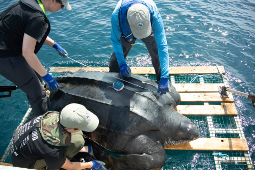
Your Canadian Geospatial Briefing for June 15th: Canadian Drone delivery solution; City of Montreal open data; Tagged leatherback sea turtles; Endangered Fish in BC
Drone company will convey COVID-19 medical equipment to First Nation Drone Delivery Canada (DDC) will transport COVID-19 medical products using…
Announcement from Drone Delivery Canada
On January 29th, 2020, Drone Delivery Canada Corp. (DDC) announced that the implementation of the DSV Air & Sea Inc.…
Your Canadian Geospatial Briefing for October 28th: Top 15 Largest Engineering Firms in Canada; Scanning the Earth with Lidar; A London Bar Uses Facial Recognition; Drone Delivery Canada and DSV Canada announcement; Canada’s Maritime Launch Services for C4M Upper Rocket Vehicle
Top 15 Largest Engineering Firms in Canada Canada has over 295,000 registered engineers in the country with an expected continuation…
Your Canadian Geospatial Briefing for September 3rd: Is The GIS Market Vertically Challenged?; StatsCan using satellite data to estimate crop/yield production; Director of Data and Digital for the Government of Canada leaves to join AI Global; MDA Selected to Build Robotic Interfaces for the Canadarm3 on NASA-led Gateway; Teledyne Optech and LiDAR USA partner in dynamic new mobile UAV sensor integration; Drone test flight successfully delivers prescription drugs in Canada for the 1st time
Is The GIS Market Vertically Challenged? Will Cadell attended GoGeomatics GeoIgnite event last spring in Ottawa, ON. During his time…


