Community
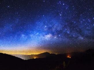
A Starry-Eyed Weekend
It was another long weekend (Victoria Day) and as usual I was searching for accommodations in and around BC at the very last minute. I was almost about to give up on my search when […]
It was another long weekend (Victoria Day) and as usual I was searching for accommodations in and around BC at the very last minute. I was almost about to give up on my search when […]
Dam Fine Data: Sub-millimetre-resolution UAS Dam Surveys Mapping heat flow beneath Greenland highlights geothermal ‘freak zone’ Stunning First Imagery of Earth From Advanced GOES-18 Satellite Military experiment demonstrates intersatellite laser communications in low Earth orbit […]

A study on eastern wolves near Georgian Bay is taking a unique approach by braiding western scientific techniques together with Indigenous knowledge systems. Researcher Jesse Popp and Theodore Flamand, the Wiikwemkoong species-at-risk coordinator, are working […]
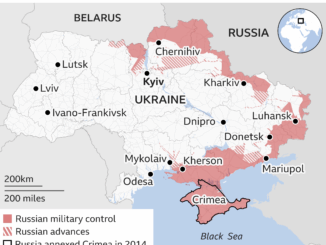
Russia’s invasion of Ukraine on February 24, 2022, sent shockwaves through the global community. As tension escalated in the months and weeks preceding the invasion, world leaders were divided as to whether or not a […]

Satellite Imagery Shows Amazon Rainforest Heading Towards Tipping Point New research in the Amazon rainforest shows the alarming rate of deterioration in one of the world’s most diverse and important ecosystems. Analyses using satellite imagery […]

Redefining what a map can be with new information and AI, new features coming to Google Maps, including AR for airports and malls, eco-friendly routes A recent update on Google Map has seen many new […]
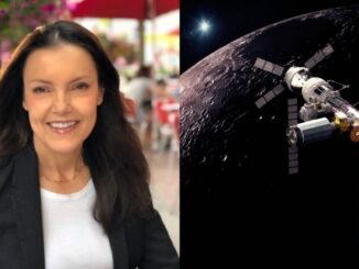
Lisa Campbell becomes the first woman to head the Canadian Space Agency – CBC The Government of Canada announced earlier in September, 2020, that Lisa Campbell will take over from Slyvian Laporte as the president […]

Google Maps Platform gaming solution now available to everyone Google first launched a gaming solution to bring real-world games to life with a limited group of studios two years ago. From this, 10 games have […]