
Community
Over Christmas, I had the opportunity to go ‘off island’. One of the pleasures of visiting Victoria, British Columbia is to go into Munro’s bookstore and to browse the shelves. In the same time frame, […]
Back in 2006 I (Jim) was a student at BCIT and a Vancouver resident, eager to obtain some local data for a project. I sent a hopeful email to City of Vancouver (COV) requesting the […]
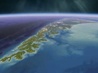
This blog is a sequel to last month’s discussion on ‘think global, act local‘. It looks at the the Gowgaia Institute and their use of Geomatics technologies, including an interview with John Broadhead a director […]
Cambridge, ON – November 23, 2015 – exactEarth Ltd., the leading provider of Satellite AIS data services, announced today that it is investing AUD $2M to secure a minority ownership position in technology company, Myriota […]
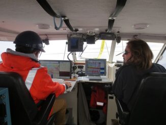
This article was reprinted with permission from the Ontario Professional Surveyor, Volume 56, No. 3, Summer 2015 By Theresa Nicholsi, Scott Youngblutii, Jonathan Mooreiii and Ryan Harrisiii. The 2014 discovery of HMS Erebus, one of […]
This months speaker will be discussing his project mapping historic Ottawa. Kevin Ballantyne, Geomatics Specialist at MDA, will be giving a talk on his work mapping some of the lost parts of our community […]
The city of Ottawa has seen its urban landscape change throughout its history. As in many major cities, small buildings have been replaced with larger ones as the city grew. After Ottawa was chosen as […]