
Community
Last year GoGeomatics brought our readers up to date on the 2012 country report from NRCan to the United Nations. This year we are taking a look at some of the highlights of the 2014 […]
David Lepage, in his blog for Axiom News, expresses concern for “the map is not the territory” in a community economy. One of the cornerstones of rural economic development is asset mapping (see Kretzmann and […]
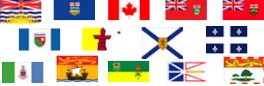
The Canadian Council on Geomatics (CCOG) has been around for over 40 years. Despite that, many people in geomatics aren’t aware of the significant role this federal-provincial-territorial government organization plays in the sector. To help […]
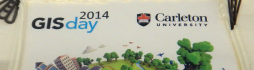
GoGeomatics celebrated GIS Day yesterday at Carleton University in Ottawa, part of the worldwide GIS Day celebrations. We would like to extend a big thank you to the MacOdrum Library‘s Maps, Data and Government Information Centre, […]

On Monday, November 17, GoGeomatics visited Natural Resources Canada for their kick-off to Geography Awareness Week 2014. Invitations were extended to all NRCan departments to come out and learn what’s happening with the CCMEO – […]
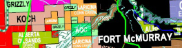
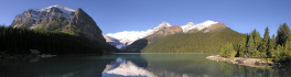
Looking for oil and gas is big business in Western Canada, and like all important ventures it needs proper planning. A small investment in pre-planning in securing relevant maps, data, software, geomatics services and advice […]
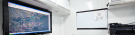
The Canadian geomatics industry is full of small and medium-sized companies offering innovative products and services. One such company is Sight Surveillance, a Sexsmith, Alberta-based personnel tracking system, providing coverage in remote work areas of […]