internet

SaveTheMap Campaign: What is the future of geospatial information in India

SaveTheMap Campaign: “to encourage citizens and startups to use geospatial data in everyday lives and create businesses that serve India”…

#GISTRIBE Hashtag: The GIS Twitter Community

GoGeomatics recently had the opportunity to chat with Emily Garding, the founder of #GISTRIBE. Emily is a Wildlife Biologist who…

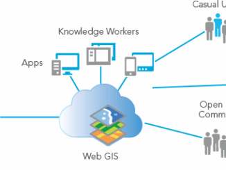
Paul Barker: What is Web GIS? Exploring the ‘new’ GIS

GIS has always been an integral part of forward thinking organizations. However, it has long struggled to break out of…

Location Encoding Systems – Could geographic coordinates be replaced and at what cost?

Geocoding is the process of converting a street address into a physical location that can be described with a pair…

UNB & Google Maps: New EarthView3D Technology

University of New Brunswick researcher, Yun Zhang, is no stranger to Google Maps. In 2000, he participated in a Street…

Map Tiles and Cached Map Services

  The tiling of large maps is an old practice. Large paper maps have always been divided into a series…

Local Action & Geomatics: the Gowgaia Institute on Haida Gwaii

This blog is a sequel to last month’s discussion on ‘think global, act local‘. It looks at the the Gowgaia…

Canadian Firm exactEarth Invests in Satellite ‘Internet-of-Things’ Technology Company

Cambridge, ON – November 23, 2015 – exactEarth Ltd., the leading provider of Satellite AIS data services, announced today that…

QGIS, GDAL & Python: Exploring The Lost Buildings of Ottawa

The city of Ottawa has seen its urban landscape change throughout its history. As in many major cities, small buildings…

Cumberland County, Maine USA

Interview: Canadian Cartographer in Australia

GoGeomatics has reached all the way across the world to Australia to interview our next guest. Today we have a discussion with Jennifer Johnston whom has taken the time to talk about some of her Cartography experiences and what she thinks about the Geomatics industry.

OGC Seeks Sponsors for FutureCities Pilot

The Open Geospatial Consortium (OGC®) in collaboration with buildingSMART International (bSI) invites sponsorship in a pilot project to help cities…

DisasterLAN Successfully Implemented by Alberta’s Emergency Management Agency

After a competitive RFP process, the Alberta Emergency Management Agency (AEMA) has chosen Buffalo Computer Graphics’ (BCG) DisasterLAN (DLAN) as…