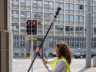
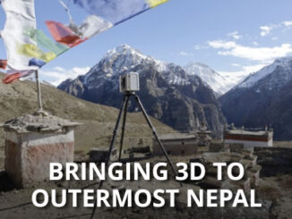
Bringing 3D to Outermost Nepal
The Research Mission The Nezar Temple has stood in the village of Bijer for over nine centuries and is among the oldest Buddhist monasteries outside of Tibet. Bijer, with a present population of 250, is in […]
How can today’s surveyors prepare to best support the growing demand to create Smart Digital Realities? This is the question we posed to Thomas Harring, president of Hexagon’s Geosystems division and CEO of Leica Geosystems. […]
An innovative prism pole, the first of its kind, addresses three troublesome sources of error for robotic total station operation. Leica Geosystems (part of Hexagon) has just announced the TP20 AutoPole, a very smart new […]
Join us on 25 February to learn about the 3D city modelling module in Leica HxMap, Leica Geosystems’ high-performance unified LiDAR and image processing workflow for airborne sensors. Product manager, Felix Rohrbach, will provide detailed insights […]
On March 1st and 2nd land surveyor professionals, as well as industry exhibitors, headed to Ottawa for the 2017 Canadian Surveyors Conference. The annual general meetings of land surveyors associations was also held on February […]
The Canadian Institute of Geomatics (CIG) Nova Scotia Branch and the Geomatics Association of Nova Scotia (GANS), two regional professional organizations that foster the application of geographic information within the geomatics sector recently collaborated to host a high resolution mapping workshop at the Centre of Geographic Sciences (COGS) in Lawrencetown, Nova Scotia. […]
High Resolution Coastal Zone Mapping This collaborative effort by GANS & the CIG will engage the geospatial community & increase awareness on the value that geospatial data provides to effective decision making January 30, 2017 (Halifax, NS) – Next week […]
The coastal zone, that dynamic geographic region where the interaction of the sea and land occurs, is vital to the lifestyle and economy of Atlantic Canada. Having quality geospatial data is essential for mapping coastal […]