Software Development – The Key to Ecere’s Success
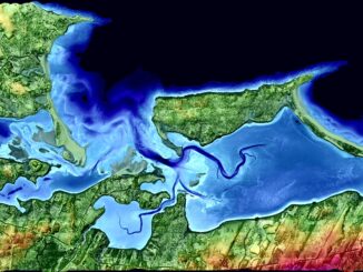
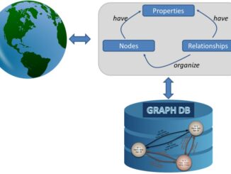
It is rare to learn of a GIS company in which much R&D is done up front to create the programming language used to build its tools. Ecere, a Canadian company based in Gatineau, Québec, […]
Tuesday, February 21, 2017 – 6:30 PM One Eighty Hunter Street 180 hunter street, Peterborough, ON This month we have a very special guest speaker joining us. Juliana Pentikainen, GIS Technologist at City of Peterborough, will […]
What I want to share with you are some resources related to something called Massive Open Online Course (MOOC) where you can learn new skills, refresh your current ones or to simply satisfy your thirst […]
This is the first of two articles on the release of ParcelMap BC Data, which we see as a significant event in the movement towards Open GIS Data in Canada. This month we’ll cover the […]
High Resolution Coastal Zone Mapping This collaborative effort by GANS & the CIG will engage the geospatial community & increase awareness on the value that geospatial data provides to effective decision making January 30, 2017 (Halifax, NS) – Next week […]
Graph Databases and GIS & Technology (GIS&T) In the era of big data, graph databases are becoming very popular as they can address important challenges in terms of data size and data complexity. A graph […]
I spent Christmas in Sydney, Cape Breton. While there, I had the time to read David Gauntlett’s book ‘Making is Connecting’. Gauntlett is Professor, Creativity and Design at the University of Westminister, UK. He starts with […]
In today’s geomatics society, ArcGIS, developed by Esri, is a giant and dominates the GIS software market. However, there are some other great and powerful GIS software applications. QGIS is a typical GIS application among […]