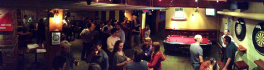
What’s New with Geospatial Niagara
So much has happened with Geospatial Niagara since my last post, seven months ago. In this post, I’ll go over where we came from, where we are today, and what we have planned for the […]
Canada, with its endless coastline, has thousands of islands. Besides the physical islands with tangible, defined boundaries, there are also cultural islands with intangible, virtual boundaries. As N.J. Turner describes in Plants of Haida Gwaii, […]
PredictION helps citizens understand the impact of proposed transit changes to their daily commute TORONTO – Esri Canada congratulates Jonathan Van Dusen, Majuratan Sadagopan and Shanqi Zhang from the University of Waterloo for winning the […]
Data collected by the Department of Fisheries and Oceans’ Canadian Hydrographic Service used to develop models of HMS Erebus FREDERICTON, NEW BRUNSWICK – Officials from Fisheries and Oceans Canada, today joined with Canadian geospatial software […]
AquaHacking is a new app challenge with an environmental focus – on the preservation of the Ottawa River. Presented by the de Gaspé Beaubien Foundation, in partnership with Ottawa Riverkeeper and IBM, AquaHacking aims to […]
VANCOUVER – PhotoSat is pleased to announce that the elevation data processed from DigitalGlobe’s new 30 centimeter resolution satellite, WorldView-3, has been verified as accurate to within 15 centimeters. DigitalGlobe is a leading global provider of […]
Intergraph®, a global leader in public safety solutions, and Esri®, a global leader in GIS technology, are collaborating to enhance geospatial capabilities for public safety and security agencies. Through the collaboration, the companies will work […]
Draganfly Innovations Inc. releases an advanced precision agriculture solution that redefines the way agricultural data is collected and viewed. The camera simultaneously captures five discrete spectral bands, which provide useful data for monitoring crops and […]