Open Source
My COGS GIS Education, Part II
In my first article, I introduced the how and why I chose to attend COGS from the fall of 2014…
GIS Open Source versioning tool for a multi-user Distributed Environment (part 2)
Cet article est aussi disponible en français. This article is the 2nd part of GIS Open Source versioning tool for a multi-user Distributed…
Outil de versionnement des données géographiques à code source ouvert pour des environnements multi-contributeurs (partie 1)
Note des éditeurs : Cet article a été écrit conjointement par Nicolas Gignac, Dami Sonoiki (eHealth Africa) et Samuel Aiyeoribe (eHealth Africa). Ces auteurs…
GIS Open Source versioning tool for a multi-user Distributed Environment (part 1)
Editors note: This article has been jointly written by Nicolas Gignac, Dami Sonoiki (eHealth Africa) and Samuel Aiyeoribe (eHealth Africa). These authors…
Top Ten Climate Change Maps and GIS Applications
Awareness for climate change has been steadily increasing ever since the Green Revolution in the 1960s. There is a plethora…
GNOSIS – A New Geomatics Software Suite
Creating a new GIS from scratch is a tough undertaking. It involves a lot of innovation. Ecere, a Canadian company…
New Galileo navigation system is experiencing clock failures
Since December 15, 2016, the new Galileo global satellite navigation system has been up and running. Unfortunately, there are…
Software Development – The Key to Ecere’s Success
It is rare to learn of a GIS company in which much R&D is done up front to create the…
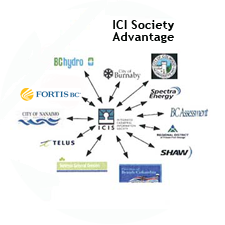
The Integrated Cadastral Information (ICI) Society and ParcelMap BC
This is the first of two articles on the release of ParcelMap BC Data, which we see as a significant…
Canadian Geomatics Innovation: Ecere Develops a Next Generation GIS
Not many companies undertake the ambitious goal of creating a new geospatial software suite from scratch. Ecere, a Canadian company…
Exploring GIS Day at the Glenbow Museum, Calgary.
I had the opportunity to celebrate GIS Day by attending the event hosted by the Alberta Geomatics Group at the…
Geospatial Development: Enhancing GIS curricula with programming skills at UNB
Geospatial information science and technology (GIS&T) has rapidly evolved over the last few decades. This evolution has created a highly…


