Your International Geospatial Briefing for September 9th: Open source to advance geospatial for multiple sectors; Location Based Policing: New LAPD Technologies. Same Racisms; Buggy GPS Trackers Expose Children’s Real-Time Location; Government investigates matching geospatial data with AI; Building Information Modeling (BIM) Market Getting Ready Deliver Gains
Open source to advance geospatial for multiple sectors
Azavea is a B Corporation. A B Corporation is a “… business that meets the highest standards of verified social and environmental performance, public transparency, and legal accountability to balance profit and purpose”
To learn more about B Corporations, click here.
Although Azavea’s mission is closely aligned, if not identical to the one describing B Corporations, it is interesting to learn further on the range of industries they provide solutions for. They provide solutions for everything from water to transportation, election to infrastructure, the list feels endless.
By serving the interest of a large variety of stakeholders, and working with the tools available within the industry, it is nice to see Azavea work in an ethical manner guided by their mission.
Open source to advance geospatial for multiple sectors
Location Based Policing: New LAPD Technologies. Same Racisms

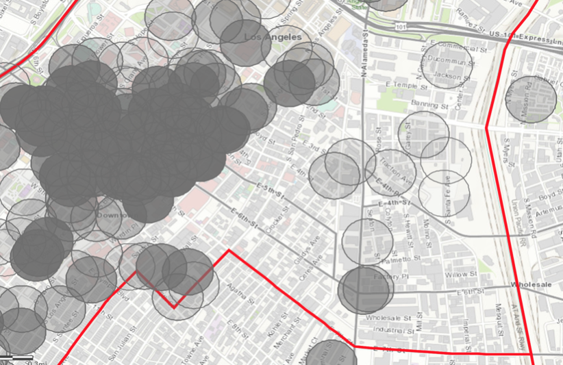
Over the last few years, we have been reading about news stories of violent policing within the United States. Skid Row is home to Stop LAPD Spying Coalition. This coalition “engages in anonymized focus groups to learn from community experience and law enforcement. [These focus groups have] re-affirmed the knowledge that LAPD racially targets and criminalizes entire communities based on demographic. In other words, they are policing a population based on location, resulting in segregated and racialized targeting.
To learn more on the Stop LAPD Spying Coalition, click here.
Location Based Policing: New LAPD Technologies. Same Racisms
Buggy GPS Trackers Expose Children’s Real-Time Location
As the era of technological advancements continues, it is common to see GPS trackers marketed to you as a means of safety. As way to ensure your pets are safe, a means to keep one’s child safe, but often we don’t see the vulnerabilities impacting these products.

Shenzhen i365 Tech has manufactured a large variety of GPS location trackers. They have over 600,000 users across the globe, and sell their merchandise on everyday platforms such as Amazon. With such a large client base, sometimes customers assume safety and security within the product, but unfortunately that is not always the case.
Issues such as the use of unsecure websites delivering the data to the customer, allowing easy hacking. Or even issues such as design flaws, allowing hackers to use the customer’s microphone or fake user locations. Although more vulnerabilities were discovered, the first two are scary enough. Always do your research on not only the product, but the supplier.
Buggy GPS Trackers Expose Children’s Real-Time Location
Government investigates matching geospatial data with AI
A UK report funded by the Geospatial Commission and govtech venture firm public states that “location data is valuable to public and private sector organisations and can be used in combination with advanced technologies in areas ranging from tackling crime hotspots, to finding the quickest routes for emergency services, to deciding where best to locate warehouses”.
By unlocking the value of location data with other technologies, such as AI, who knows where it will lead the UK. As further studies and research advancements are funded, they will be better prepared to work with these immersive technologies for the better of its population.
Government investigates matching geospatial data with AI
Building Information Modeling (BIM) Market Getting Ready Deliver Gains

According to experts from Allied Market Research, the global Building Information Modeling (BIM) market in expect to grow at a rate of 21.6% from 2015 to 2022.
As technological advancements continue to appear, the innovators are seeing the values in combining them with BIM software, such as Virtual Reality. This is not just for VR gaming at home, but for everything under the sun, such as using this software in testing mobility services and automotive advancements.
With so many current uses, and so many left to come, no wonder the BIM Market is growing so rapidly.
Building Information Modeling (BIM) Market Getting Ready Deliver Gains


