power
Geospatial Earth Observation Using Blimps, Balloons and Kites
These days drones are all the rage. Nevertheless, there are other ways to collect data from the sky! Blimps, balloons and kites…
Interview with Sam Scovill, GIS Technician and 3 Day Champion on Jeopardy
Every weeknight, my mom and I watch Jeopardy together. Jeopardy always starts with the announcement of the contestants by their…
Upgrade your Geospatial Skills: leveraging the power of MOOCs
What I want to share with you are some resources related to something called Massive Open Online Course (MOOC) where…
Graph Databases – Recent development in Neo4j may help accommodate the Geospatial Community
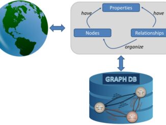
Graph Databases and GIS & Technology (GIS&T) In the era of big data, graph databases are becoming very popular as…
Making is Connecting: the social meaning of creativity
I spent Christmas in Sydney, Cape Breton. While there, I had the time to read David Gauntlett’s book ‘Making is Connecting’.…
The Future of GIS Software? QGIS A Popular Open-Source GIS for the Masses
In today’s geomatics society, ArcGIS, developed by Esri, is a giant and dominates the GIS software market. However, there are…
Canadian Geomatics Innovation: Ecere Develops a Next Generation GIS
Not many companies undertake the ambitious goal of creating a new geospatial software suite from scratch. Ecere, a Canadian company…
Interview with Ted Mackinnon: Promoting Canadian GIS & Geomatics on Twitter
GoGeomatics has been actively using Twitter to reach out to the geospatial community since 2009. We have written and hosted…
The 5 most interesting things that happened in geomatics in 2016
Let’s take a step back and have a look at what happened this year. To be honest, it was pretty…
Planning an Enterprise GIS from the Bottom Up
You might be an observant professional in a department that uses GIS. Your organization may be large and have many…
what3words adopted by six national mapping agencies
what3words, the multi-award winning location reference system, has today announced that six national mapping agencies have adopted 3-word addresses. Used…
CCRS in Ottawa: Big Geospatial Data Analytics Workshop
Almost a year ago a needs & requirement assessment was conducted to gather information on the potential development of a…