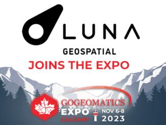
Qgis
Upgrade Your Skills with GeoTech Training: New Courses Announcement
GeoTechTraining.com has arranged the latest geo technology trends and techniques training led by leading industry experts in a safe and…
Launch of new Canadian Geospatial Training Site: GeoTechTraining
I’m pleased to announce the launch of our new Geospatial training platform GeoTechTraining.com. GoGeomatics is a constantly evolving enterprise that…
The top 6 Satellite Remote Sensing Software tools
Nowadays, satellite remote sensing comes in handy and can now be employed in our day-to-day activities. This technology, with the…
GeoIgnite 2020: Flood mapping activities & research at Natural Resources Canada
The 2020 Geolgnite conference was put online and brought the Canadian geospatial sector together for some important updates to ongoing…
Five Free and Cheap Ways to Improve Your Geospatial Technology Skills and Learn GIS to Advance Your Career
You don’t have to spend a lot of money or go back to university or college to learn or improve…
Post-Wildfire Landscape Metrics & Transition Characteristics in Cariboo Regional District, 2017
The summer of 2017 marked one of the worst fire seasons in British Columbia’s history. By October, wildfires had covered…
Your International Geospatial Briefing for February 10th: AI and Facial Recognition, a Geoprivacy Issue; Velodyne releases $100 lidar sensor; 1st Annual QGIS Conference; The Coronavirus Map
AI and Facial Recognition, a Geoprivacy Issue More and more, people associated facial recognition technology with privacy issues. However, few…
The Best Open Source GIS Certificate Program in the World is Canadian
This interview is part of a series of interviews spanning the depth and breadth of the Canadian GIS community. We…
Using Swipe Maps to View Wildfire Destruction in BC
On July 7, 2017 a series of devastating wildfires began in the Cariboo region of British Columbia. The effects of…
Mapping Migration Flows with QGIS FlowMapper Plugin
Flow mapping is a technique to visualize movement of objects of interest between geographic areas. Typical uses of flow maps…
QGIS: Performing Viewshed Analysis on Archaeological Sites
In 1927 a Vancouver bylaw was enacted that limited the height of buildings to a maximum of six stories in…
Google Summer of Code Projects: Open Source Geospatial 4 every student
Are you are university student who has solid programming skills, geospatial knowledge and is continuously aiming to become better at…