
Community
Open Data, Open Source, Open Possibilities
Back in 2006 I (Jim) was a student at BCIT and a Vancouver resident, eager to obtain some local data for a project. I sent a hopeful email to City of Vancouver (COV) requesting the […]
Back in 2006 I (Jim) was a student at BCIT and a Vancouver resident, eager to obtain some local data for a project. I sent a hopeful email to City of Vancouver (COV) requesting the […]
This months speaker will be discussing his project mapping historic Ottawa. Kevin Ballantyne, Geomatics Specialist at MDA, will be giving a talk on his work mapping some of the lost parts of our community […]
The city of Ottawa has seen its urban landscape change throughout its history. As in many major cities, small buildings have been replaced with larger ones as the city grew. After Ottawa was chosen as […]
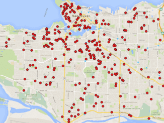
A friend of mine who volunteers with a girls’ softball team came to me with a request recently. “I have the addresses of all of the girls in our softball league”, she said. “I want […]
This article focuses on the process of creating a very out-of-date map in GIS. Lots has gone on since I posted Gettysburg: What Could Lee See? last summer. Technology continues to evolve at a dizzying […]
This article is the first in a monthly GoGeomatics Canada series on topics related to Open Source GIS for Everyone, by Rick Davidson and Jim O’Leary, Continuing Studies (CS) instructors at Langara College in Vancouver, […]
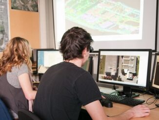
The BCIT GIS department has been graduating students for 25+ years. Our students come from BC, but as well, across Canada and international. Our program is known to be very demanding, and creates students that […]

Well, it’s not really a secret. To be totally honest, I asked Alex Miller, President of Esri Canada, if I could write an article about it and he gave me the thumbs up. So here […]