• facebook
  • Twitter
  • Linkedin
  • Youtube
  • Linkedin Group
  • Post a Job
  • Post an Ad
  • Post an Event
  • Post a Directory Listing
  • Post a Press Release
  • Media Kit
  • My Account
  • Login
GoGeomatics
  • MAGAZINE
    • BIM & GIS
    • Community
    • Conference news
    • Earth Observation
    • Education & Careers
    • GEOAI
    • Announcements
    • Reality Capture & Lidar
    • Science
    • Technology
  • Directories
    • ASSOCIATION
    • INDUSTRY
    • EDUCATION
    • Open Data
  • EVENTS
    • GeoIgnite Events
    • Events Calendar
    • GoGeomatics Meetups
  • Services
    • Advertising
    • Marketing
    • Post a Job
    • Post an Ad
    • Post an Event
    • Post a Press Release
    • Post a Directory Listing
    • Media Kit
    • Web Design
  • Find a Job
  • Volunteer
    • Start a GoGeomatics Group
    • Editors & Writers Group
  • About Us
    • About Us
    • Contact Us
    • Frequently Asked Questions
  • Videos
HomeRAC

RAC

|Vancouver social|||
Newsmakers & Press Releases

UBC Unveils New Masters of Geomatics for Environmental Management

8 February 2017 GoGeomatics Newsmakers | 2017

The UBC Faculty of Forestry is excited to announce that the official approval of the Master of Geomatics for Environmental Management (MGEM) Program. We are now accepting applications and will welcome our first cohort in August, […]

|Vancouver GoGeomatics Group|
Education & Careers

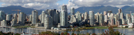
Vancouver Geospatial Career Seminar February 23rd

8 February 2017 GoGeomatics Canada | 2017

GoGeomatics Canada is bringing our popular career seminar to Vancouver this February. This is only the second time we have offered our Career Seminar in Vancouver, and we’re looking forward to meeting all the new […]

Community

Canadian Geography & Geo-Literacy: The GeoNiagara Radio Show is on the air

7 February 2017 Darren | 2017

The GeoNiagara Radio Show seeks to engage and inform educators, students and the broader community about the relevance and importance of geography as a discipline and geo-literacy as an educational necessity in a world that […]

||||||
Education & Careers

Geospatial Earth Observation Using Blimps, Balloons and Kites

7 February 2017 Theresa Pinter | 2012

These days drones are all the rage. Nevertheless, there are other ways to collect data from the sky! Blimps, balloons and kites are alternative was to collecting data or remote-sensing imagery. These are great unconventional solutions for […]

||
Technology

New Galileo navigation system is experiencing clock failures

6 February 2017 David Boileau | 2015

  Since December 15, 2016, the new Galileo global satellite navigation system has been up and running. Unfortunately, there are some technical difficulties on the horizon, having to do with the clocks that are on […]

Technology

Software Development – The Key to Ecere’s Success

2 February 2017 Ozair Khan | 2012

It is rare to learn of a GIS company in which much R&D is done up front to create the programming language used to build its tools. Ecere, a Canadian company based in Gatineau, Québec, […]

||Figure5: iMapBC Start|Cadastral Fabric Definition|Cadastral Fabric Definition|Cadastral Fabric Definition
Community

The Integrated Cadastral Information (ICI) Society and ParcelMap BC

30 January 2017 GIS Program Langara CS | 2016

This is the first of two articles on the release of ParcelMap BC Data, which we see as a significant event in the movement towards Open GIS Data in Canada. This month we’ll cover the […]

Education & Careers

Graph Databases – Recent development in Neo4j may help accommodate the Geospatial Community

26 January 2017 Emmanuel Stefanakis | 2016

Graph Databases and GIS & Technology (GIS&T) In the era of big data, graph databases are becoming very popular as they can address important challenges in terms of data size and data complexity. A graph […]

Posts pagination

« 1 … 4 5 6 … 66 »

Events

Notice
There are no upcoming events.

View All Events

Services

  • Post a Job
  • Post an Ad
  • Post an Event
  • Post a Directory Listing
  • Post a Press Release
  • Media Kit
  • My Account
  • Login

Jobs

Post a Job
  • Canada Maps and Poster Gallery Volunteer Leads — GeoIgnite 2026
    remote
  • GIS & Data Analytics Lead
    Beaumont, AB
  • Lead Surveyor, Projects/Arpenteur-géomètre principal, projets; arpenteuse-géomètre principale, projets
    North Bay, Thunder Bay
  • Senior GIS Developer
    Calgary, AB
View All Jobs
  • Directories
    • Associations Directory
    • Industry Directory
    • Education Programs
    • Open Data
  • Volunteer
    • Start a GoGeomatics Group
    • Editors & Writers Group
  • About Us
    • GoGeomatics Media Kit
    • Who We Are
    • Contact Us
    • FAQ’s
    • Advertising
    • Marketing
  • Subscribe
GoGeomatics
GoGeomatics is the largest and most popular communications hub promoting the Canadian geospatial community. The business was incorporated in 2011. GoGeomatics hosts over 100 fun, free, location technology networking events each year in cities across Canada.

© 2025 GoGeomatics

  • facebook
  • Twitter
  • Linkedin
  • Youtube
  • Linkedin Group